The White Sea: Chupa – Kem
Our summer trips can be grouped by the following factors: they last more than 2 weeks, we cover great distances, and it always rains. This year was no exception — we set off for the White Sea by kayak.
Preparation
I deliberately devote most of the story to preparation, because it might help someone on their own sea expedition just as it helped us. If you're not interested, you can scroll down straight to the Start. Planning a trip like this is super important, because we're city dwellers, and while I can stretch my "vacation," for Dasha that would cause problems at work.
Starting in May, every month we ran one paddling trip — the Klepiki lakes, Seliger, Lake Onega — in order to hone particular skills and test our gear. We began preparing and buying gear back in November of last year, and by the start of the trip we had, I'd say, everything we needed and even a little more.
I read everything on sea kayaking I could get my hands on: Sea kayaking: A Manual to Long-Distance Touring, Sea Kayaking Illustrated, The Complete Sea Kayaker’s Handbook (these books went on to help us enormously), as well as various blogs. It turned out that in Russia sea kayaking is represented by the half-dead forum siyak.rf with a very marginal crowd. In general, the touring scene is somehow underdeveloped here; kayakers more often go on whitewater runs or down rivers, and there are few reports of sea trips. We read absolutely all the reports there were; Severnye Prostory helped especially. We drew a lot from them, especially about the dreadful littoral zones. But probably the main motivator for the trip was Sasha Kuzmitsky's report.
Another important part of the preparation was the sailing directions. Although they're written for ships, you can learn about currents and weather from them — fairly important information.
All this time we'd been planning a Chupa – Kandalaksha trip, but a week before departure we realized it was a short route and that almost the whole time the opposite shore of Kandalaksha Gulf would be in view, whereas we wanted real sea. So we changed our plans to Chupa – Kem, studied the maps, and decided to start specifically from Chupa, since that would let us suffer less from the prevailing easterly and northeasterly winds blowing in off the sea, and make more use of the tidal currents. By finishing in Kem, we could head out to the Solovetsky Islands on arrival if time remained.
Food
We expected to finish the trip in 14 days, but we drew up the meal plan for 20 days in case of very bad weather. The food came to 35 kilograms, a whole backpack. You can look over the meal plan in this spreadsheet. Jumping ahead, I'll say we ate lavishly. I never felt hungry, and after rest days the paddling was just wonderful.
For snacks we bought a variety of nuts and dried fruit. We took really cool dried fruit: dried pears, peaches, candied ginger, orange peel, dates, figs, and of course the usual dried apricots and prunes.
Breakfast consisted of porridge; lunch was freeze-dried food or packet soup improved with dried mince and vegetables (bought at the Ekstrim stall); dinner was usually heartier but still quick to prepare. For treats we had pancakes and various sweets.
Dasha is a superb quartermaster; how anyone does a trip without her is the greatest mystery.
Gear
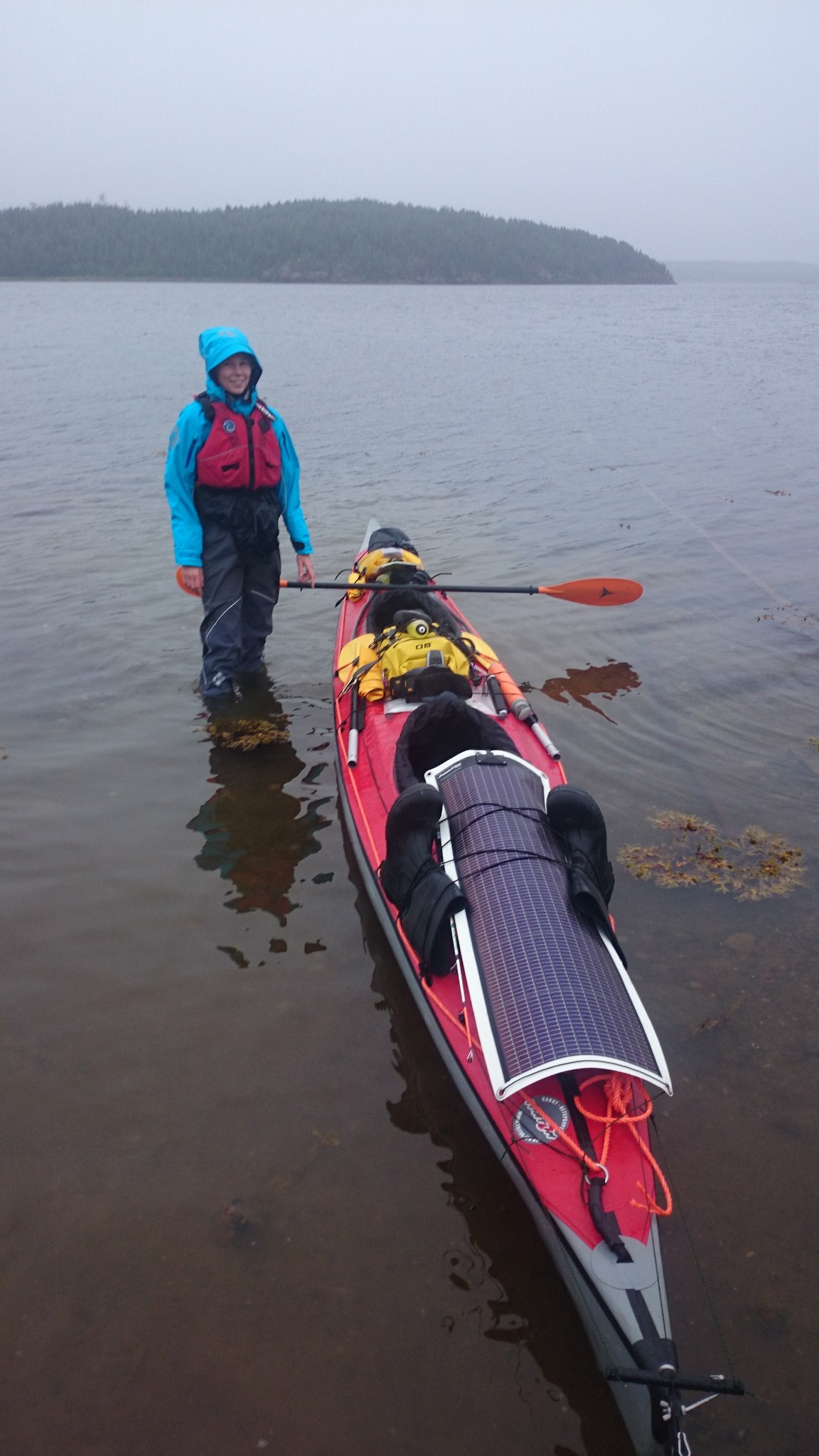
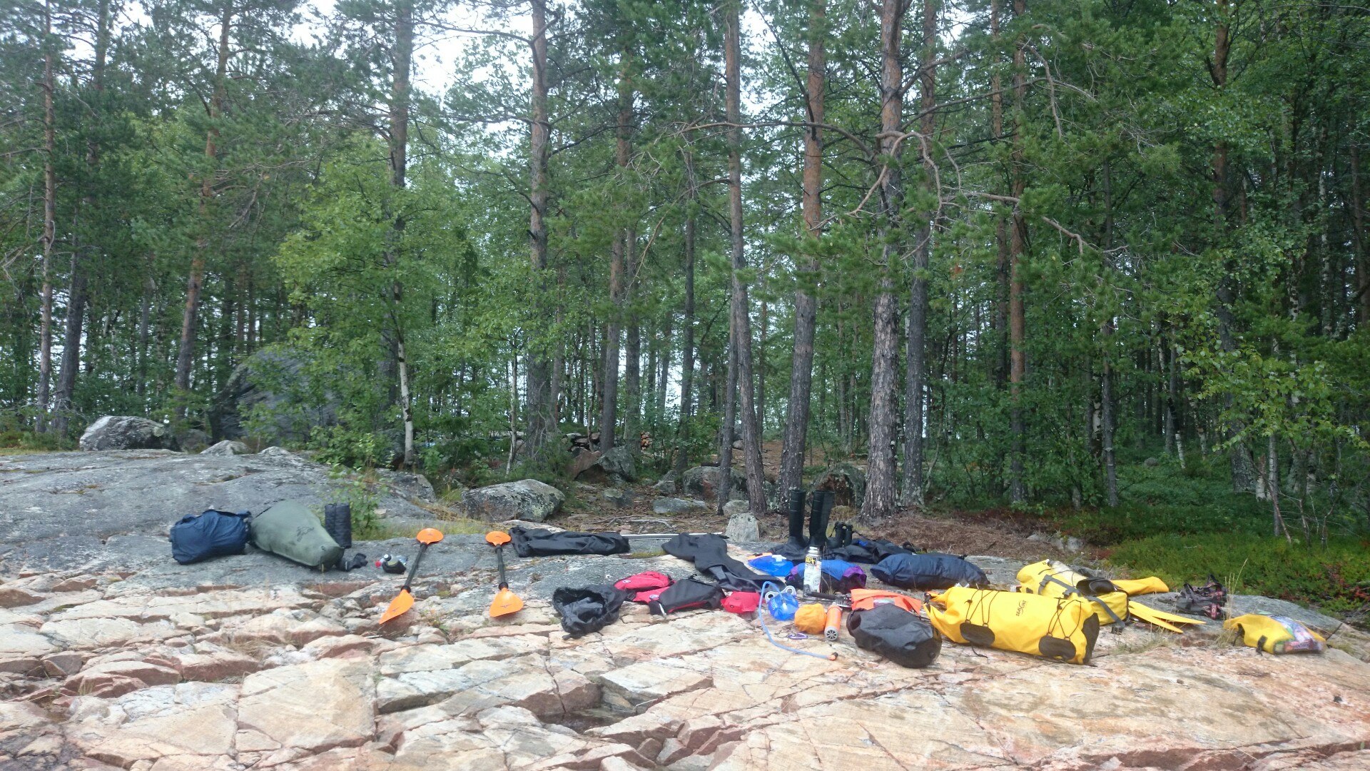
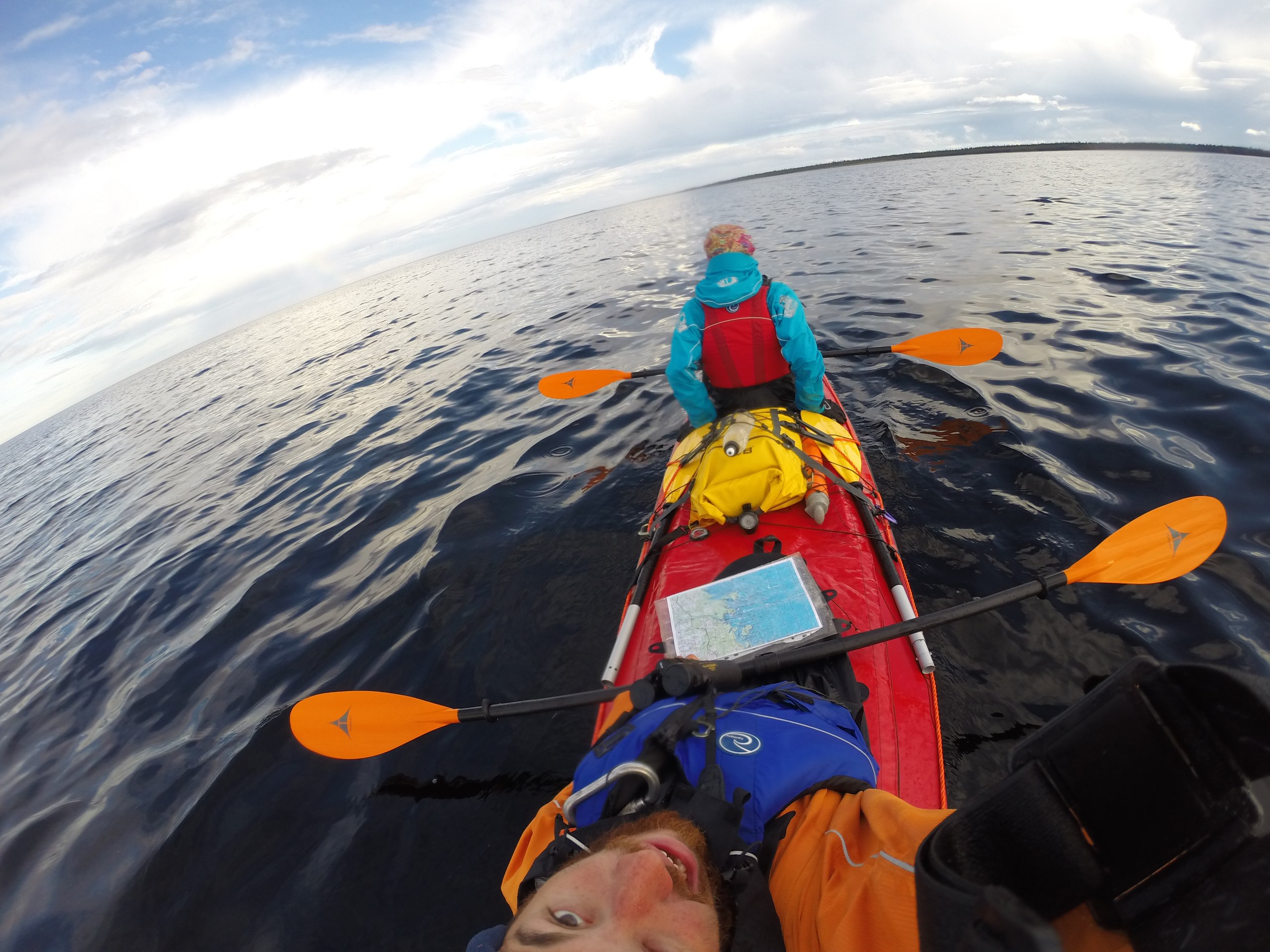
We paddled a Ladoga-2. The kayak performed excellently against headwinds and crosswinds. Having read up on how, after sea trips, people saw apart their seized-up stringers, I treated the whole frame with Quicksilver Corrosion Guard anti-corrosion spray, found at a boat shop. All the stringers are in good condition; the only corrosion was caused by a grilling grate that lay under the seat the whole time. Of course, I'd have liked to try doing the sea in plastic sea kayaks; a frame-and-inflatable kayak flexes well with the waves and loses speed because of it.
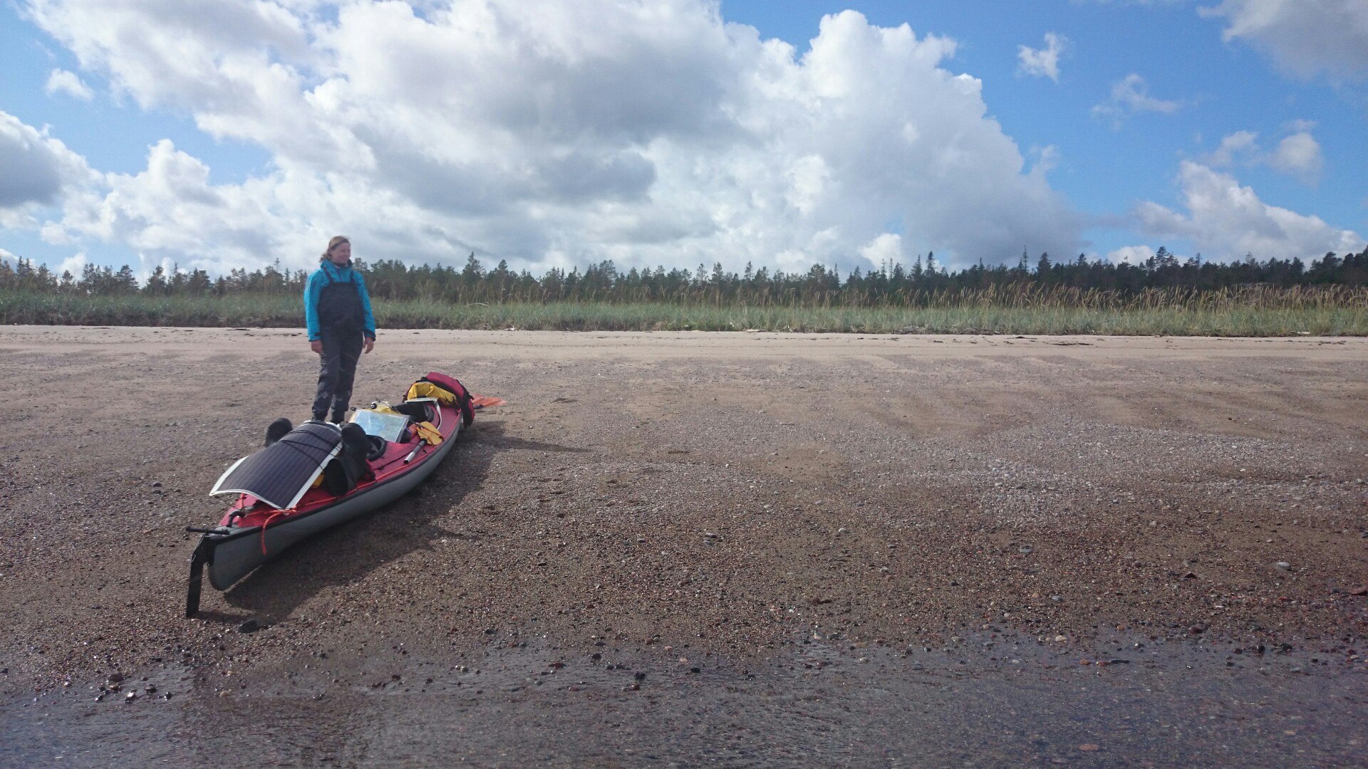
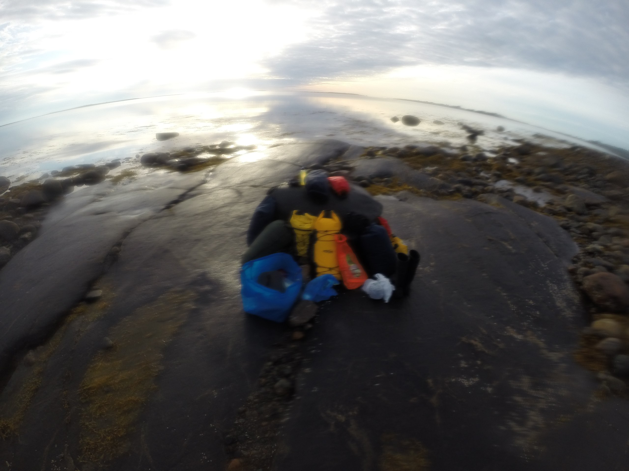
We had 3 deck dry bags with mounts: bow, middle, and stern. In the 30-liter stern bag we carried everything needed for lunch, so during lunch we didn't have to dig inside; in the center was my working dry bag with some of the electronics and warm thermal layers, spare gloves and goggles. On the bow was Dasha's dry bag with snacks and small items that might be needed at any moment, plus another small dry bag with less essential things. The dry bags were from SealLine and OverBoard. The SealLine Baja and Kodiak are the coolest. In all we had 12 dry bags besides the deck ones (almost all from Splav, various volumes and models), which held everything; only the boots and sleeping mats went without dry bags — actually not the best decision, we should have bought individual dry bags for them. The total weight of the gear exceeded 110 kilograms (together with the kayak).
The Ladoga turned out to be a far more capacious vessel than I was used to thinking. We didn't economize much on weight, didn't cut back much on gear, even decided not to take a two-person sleeping bag, and our 2 sleeping bags with inflatable mats took up a significant part of the space in the stern, but we still managed to cram it all in, especially the huge amount of food.
We also tested sea socks for the Ladoga. A wonderful thing, but you have to get used to them first; sitting becomes less comfortable, and, most importantly, they do slowly leak after all. That's not a big problem — most of the water from your feet is held in them, and they collect all the dirt.
As all the sea-kayaking books advise, we dressed for the water temperature, not the air. The water was 10–13 degrees; you don't want to swim in it, and hypothermia sets in very fast, so we chose semi-dry membrane drysuits from Palm. In general there's almost no clothing for kayakers in Russia; we bought everything at the paddler.ru shop. Excellent kit that let us calmly weather a wide range of conditions: from cold and rain to heat. The only neoprene items were the booties and mitts, which I put on twice, in the harshest conditions. We also took neoprene socks, but there was absolutely no point to them. By the way, the shop is great. There's more whitewater gear there, of course, but they have good touring kit too. The salespeople know their trade and can always advise you (unlike the shop grebi.ru, which is staffed by sour-faced jerks).
We bought new Adventure Technology Pursuit paddles. They're twice as light as the old plastic-and-aluminum paddles, and to a large extent, it seems to me, they let us cover big distances without much fatigue. Fatigue was also reduced by improved paddling technique; already on Onega it became clear how to paddle with your torso rather than your arms. A plus of the paddles is that you can set any feather angle, and I settled on around 10–15 degrees — it's much easier to hold the paddle low that way. This site can also be a good helper in mastering paddling technique. Good stuff.
Maps
Nautical charts of the White Sea either don't exist or are held only by the military. Navionics is completely silent on the matter. So all we could do was trust topographic maps. The printable maps, the General Staff 1 km sheets, I took from loadmap.net — a very good resource, though you could also use the SAS Planet program. Loaded onto the navigator were custom jnx maps, the GGC 500 m sheets, which I barely tracked down — I had to PM everyone who'd left their email in the thread about White Sea maps on RuTracker. I found and installed them, as usual, the day before departure. The paper maps, the 2 km sheets, I bought at a shop on Kuznetsky Most; incidentally, there they told me the Petersburg publisher had stopped printing the 1 km sheets of Karelia.
Electronics
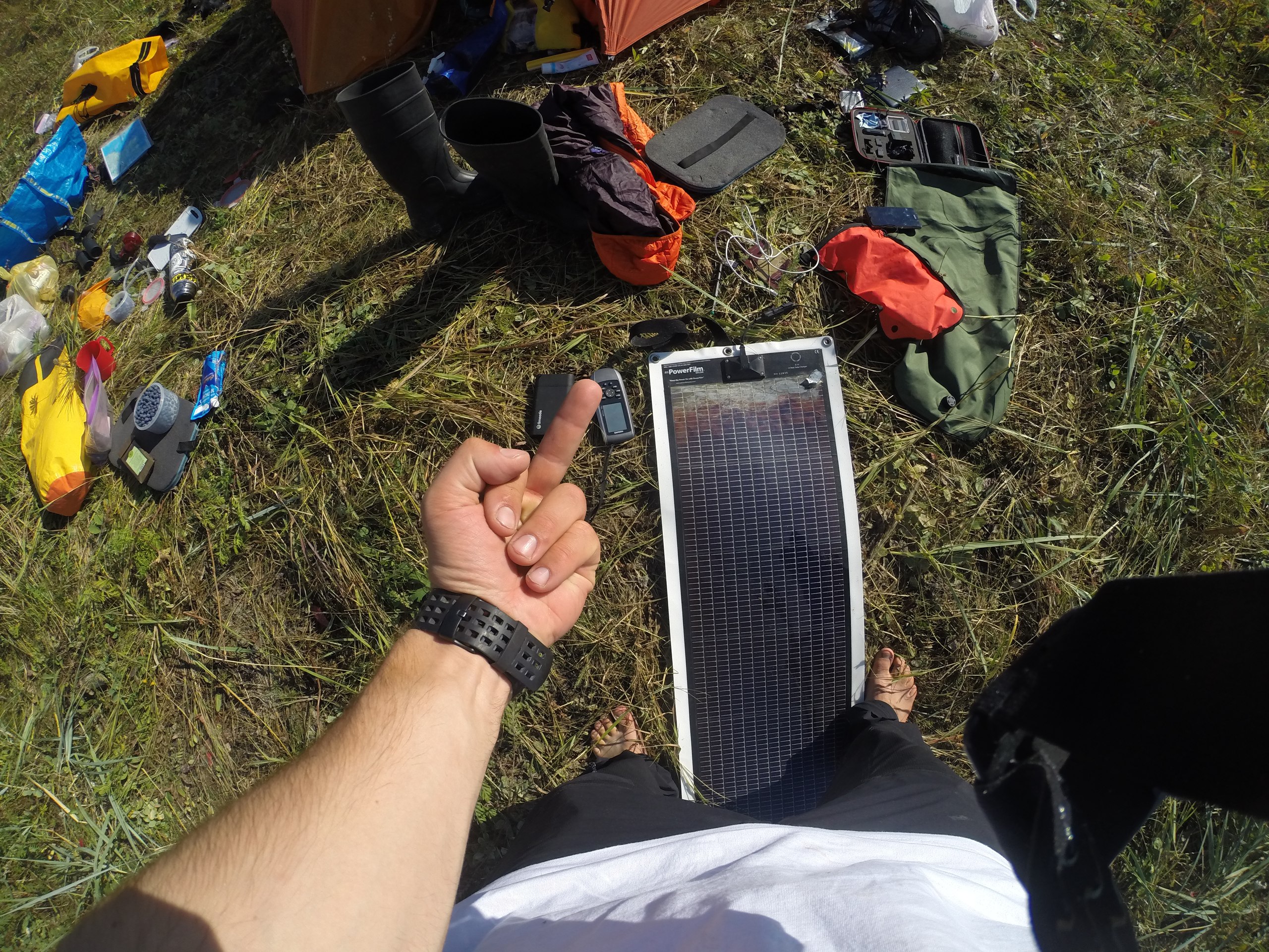
We took a Garmin marine GPS (GPSMAP 78sc), backed up with three sets of maps and two compasses, a Suunto Ambit 2 watch, a Powerfilm R-14 solar panel, an 18,000 mAh Limeade charging block, a Goal Zero Nomad 10+ charging block with AA batteries, a Yaesu VX6-R radio, a Spot tracker, a GoPro HD Hero 3+ camera with two extra 1,280 mAh Wasabi Power batteries, a pile of AA batteries, and our phones. More will be said about how the electronics performed.
We didn't take a camera at all. In general, despite my line of work, I don't like shooting photos and video on trips; it distracts you too much from the process.
Safety equipment
This was represented by life vests, PRB-40 parachute distress flares (2 per person) and red hand flares (one each), whistles, paddle floats from Harmony, and a pump for bailing water. We also had the Spot, so our parents wouldn't worry too much. The radio as a means of emergency calling turned out to be super ineffective. Vessels almost never travel the White Sea; the ones that do are apparently only military ships and submarines, and there's no one to listen to channel 16. There was also a first-aid kit assembled for every eventuality; luckily only a band-aid was needed.
For this trip I put together an excellent repair kit, one I can genuinely be proud of; it had everything, and everything was duplicated — you could fix absolutely any element of the kayak and gear except the locking stringers (incidentally, I bought spare stringers but in the rush left them at home). So we were super ready.
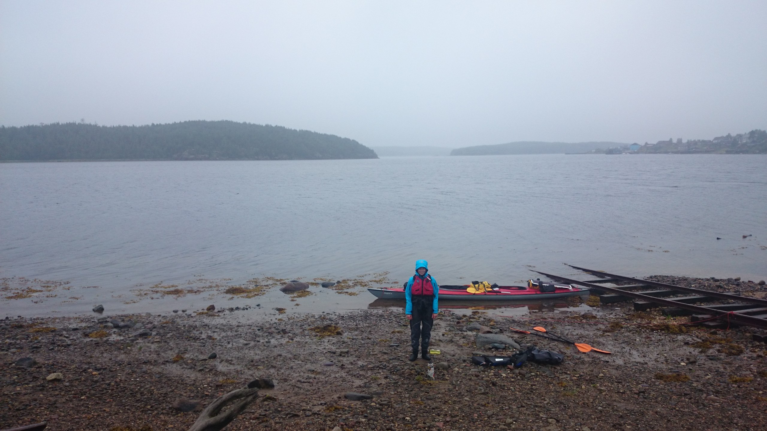
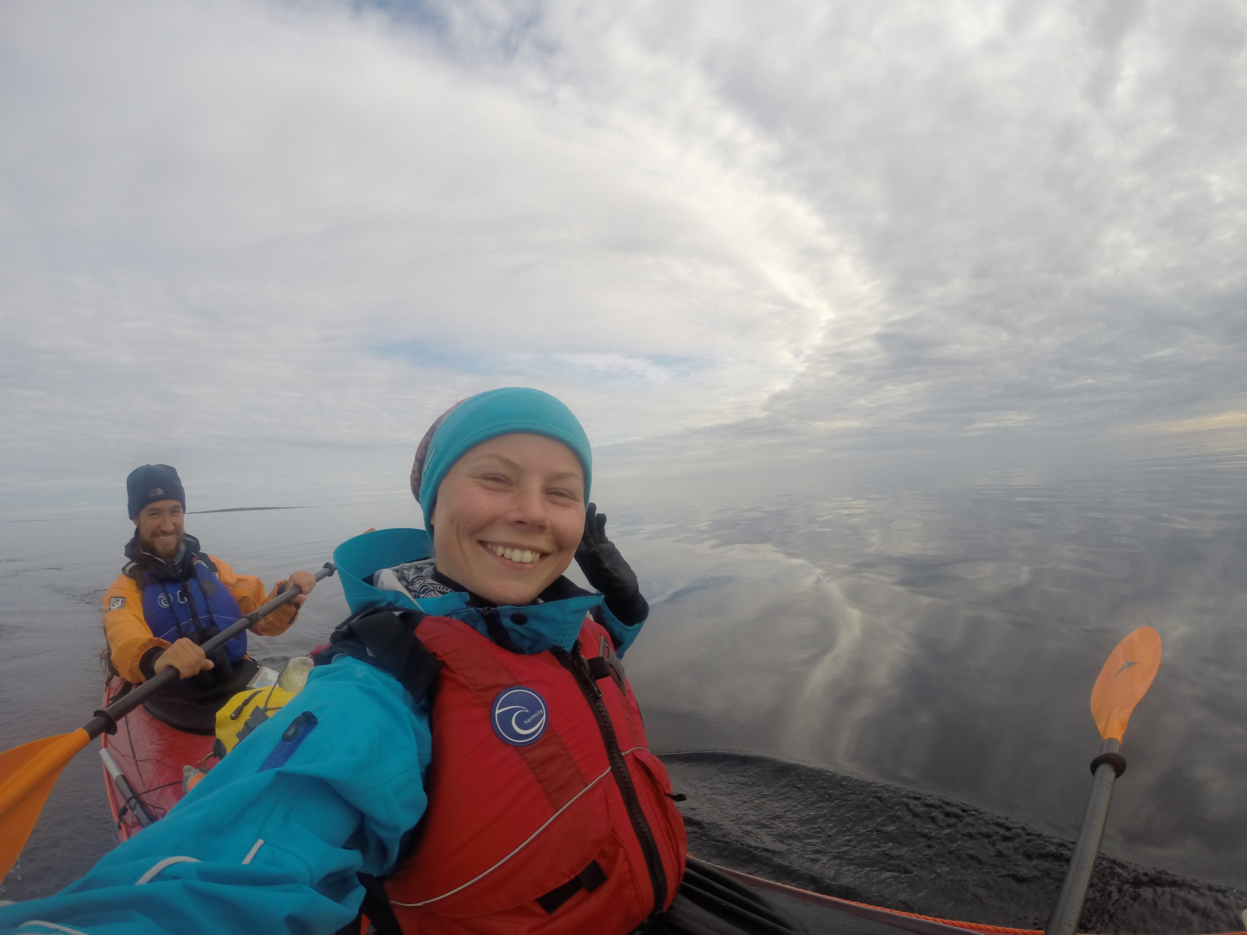
StartChupa, Aurelia
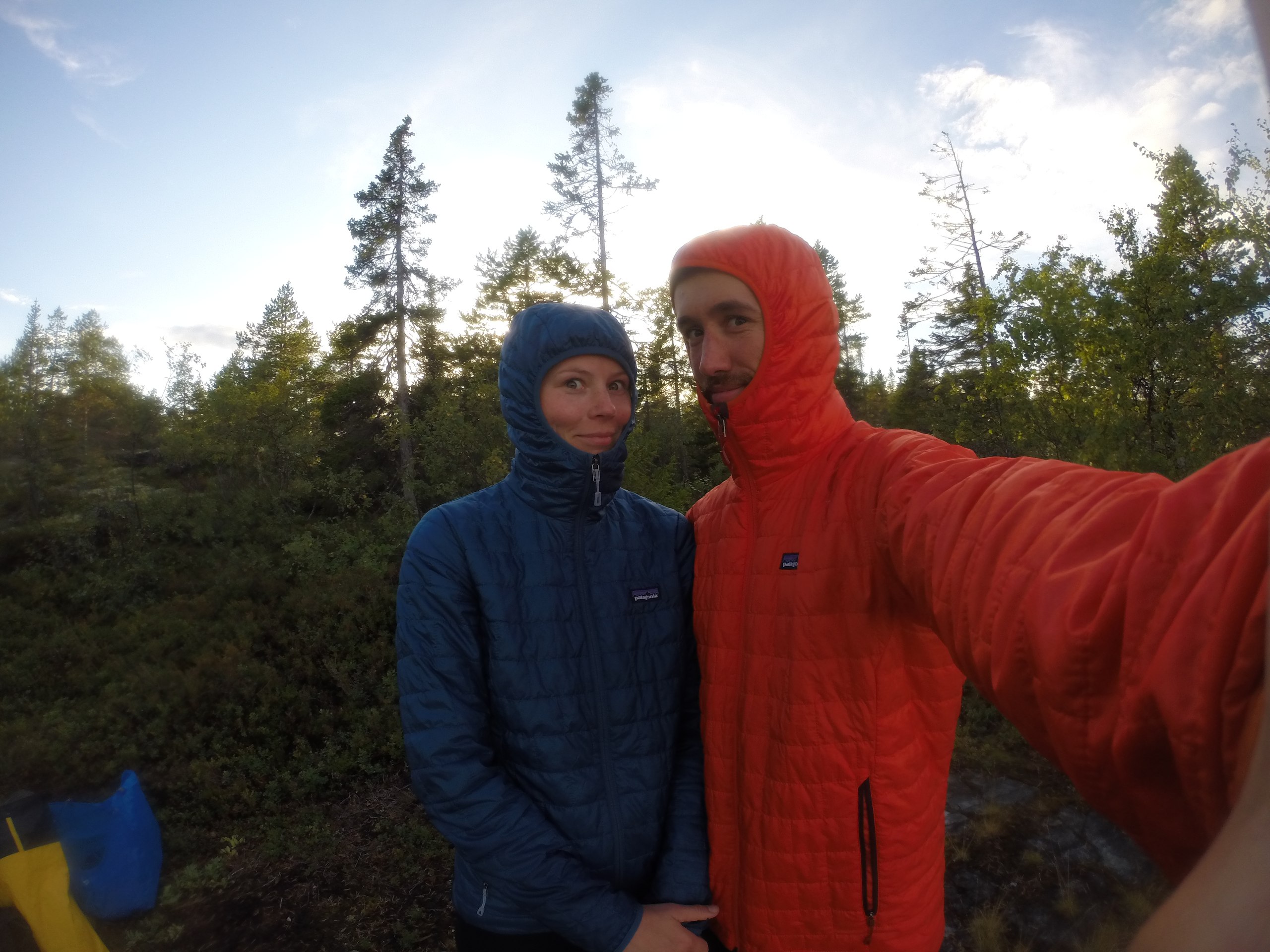
Dasha took a day off, and from Friday morning we were assembling the kayak in the hallway. The goal: to make sure we really could take all the gear aboard. The assembly went well, everything fit. We packed up, finished all our errands, and in the evening headed to the station, where Katya met us and helped with the bags.
We set off and discovered that we'd left our usual paddling jackets at home. I'd been waterproofing them before the trip and forgot them on the hanger. Luckily, Katya came to the rescue here too — she went over to our place (we'd left her the keys) and sent the jackets on a train leaving the next day, for which a huge thank you to her.
We traveled on the Arktika train, a good premium train, with air conditioning, dinners and breakfasts. Another plus of this train is that it has a baggage compartment, where we sent our kayak, the gear backpack, the food backpack and the bag of odds and ends. By the way, IKEA bags are an excellent companion on trips like this, and over the course of the journey those bags helped us carry a large amount of gear in a single trip more than once. Riding in our compartment was a kayaker who was very surprised by our plans. Incidentally, no one who heard what we were about to do expressed much support; we heard only bafflement and the words "it's dangerous." Well, like any pursuit of the sort. On the other hand, I'm not sure people pictured the route from Chupa to Kem.
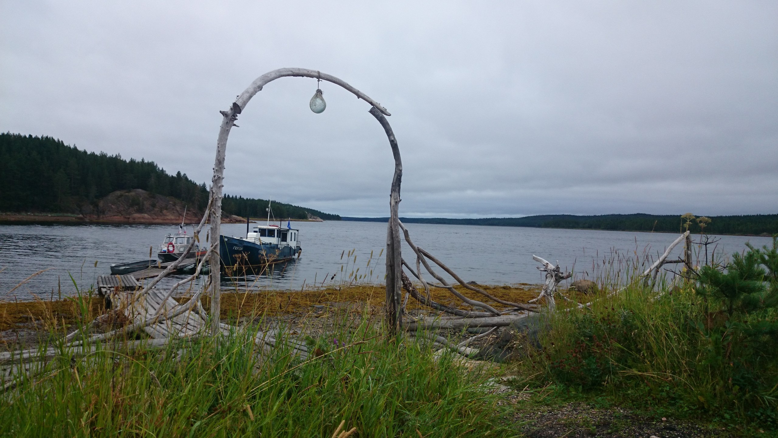
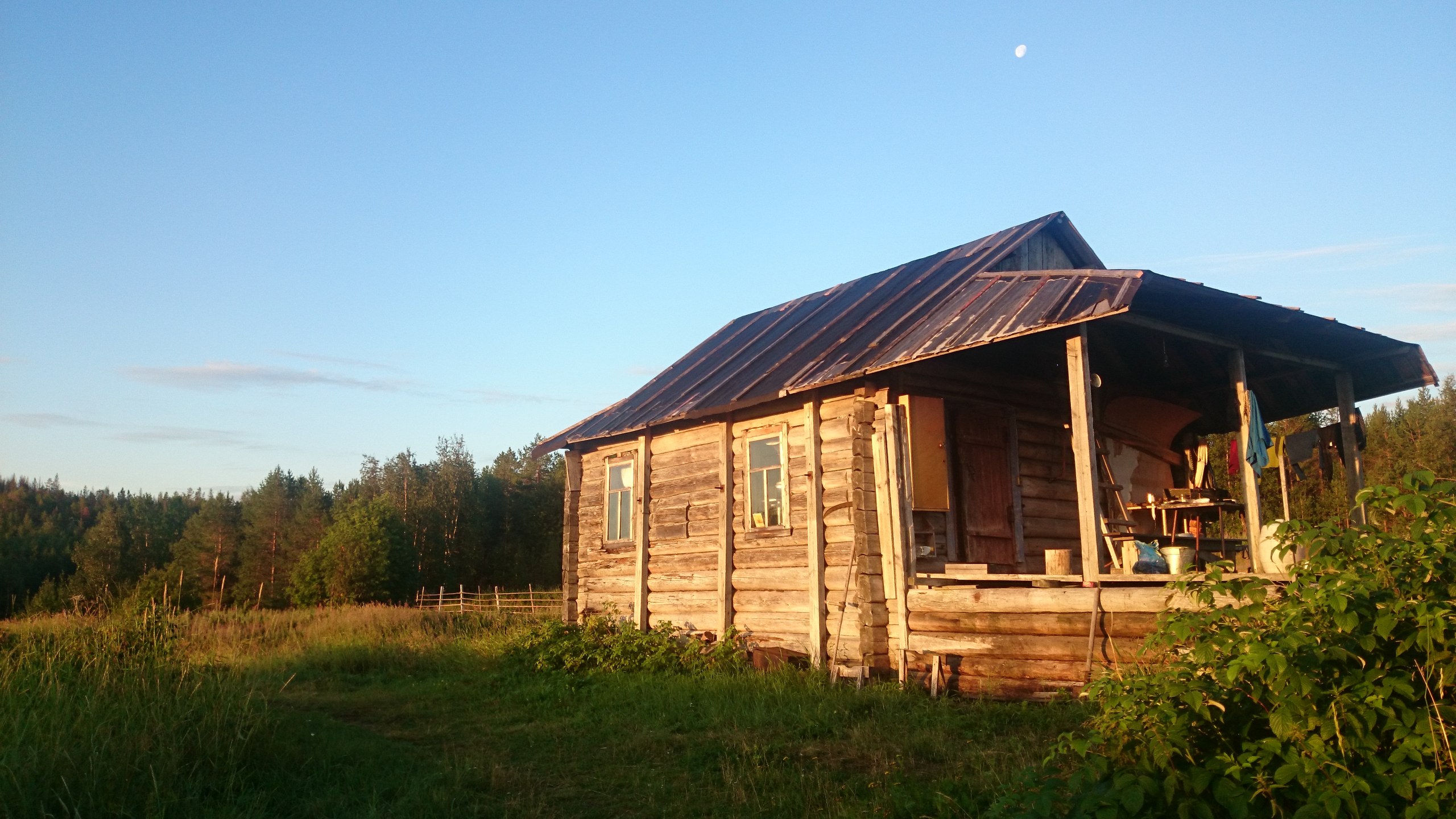
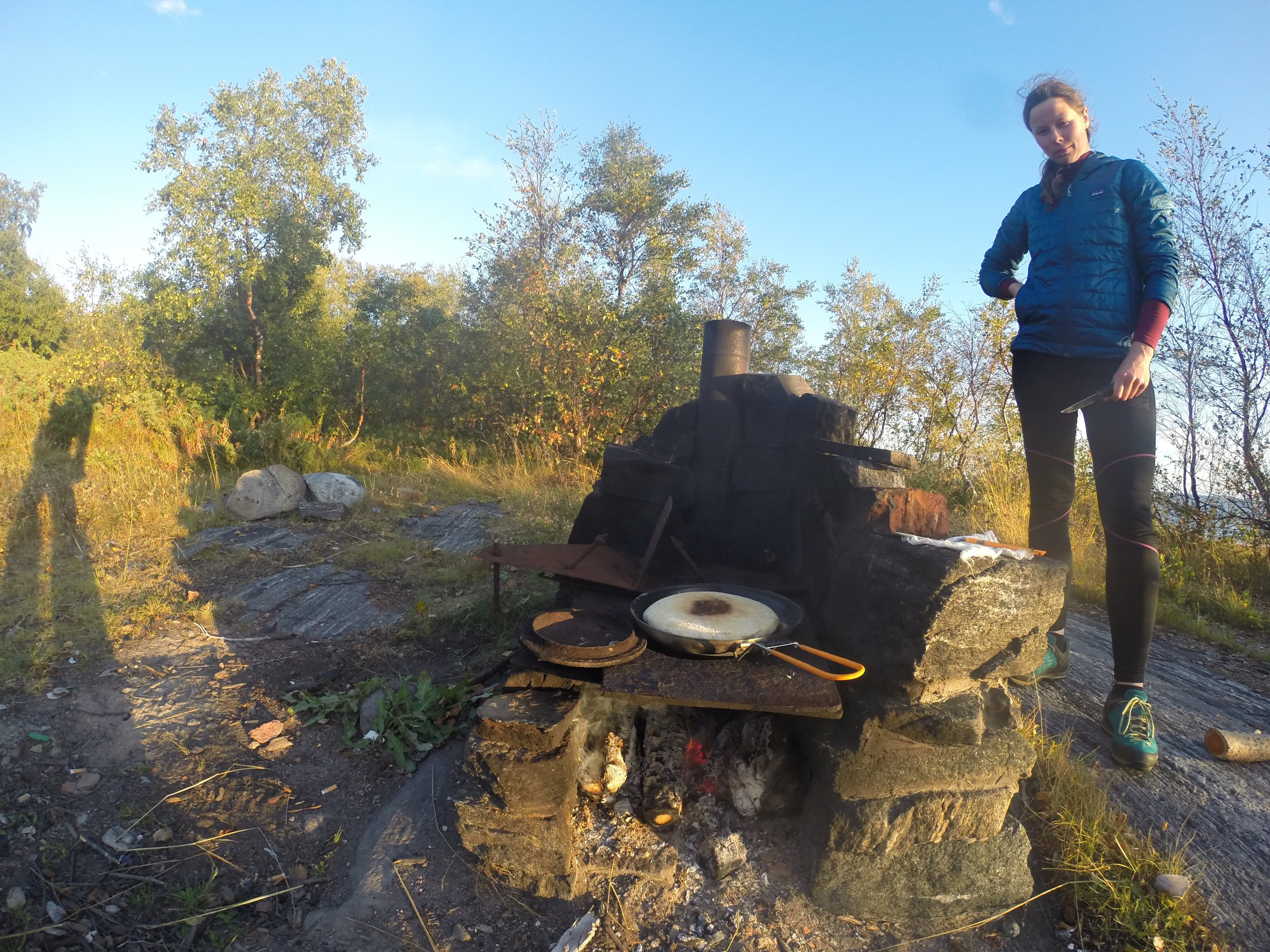
The train stops at Chupa station for only three minutes, and at 4 a.m. we were already in the vestibule, ready to jump out quickly. We managed to do it within 3 minutes, and three minutes after that we were loading into the Chevrolet Niva of the local driver, Nikolai Arkadyevich, who took us to the Aurelia guest house, which stands on the shore of the bay. The hostess, Galina, met us and showed us to a small but tastefully furnished room in the cottage.
At the start of the week, when I'd called Galina, they'd had great weather, +28. But when we arrived, a low leaden sky hung overhead and it was drizzling. Still, we were mentally and physically ready for this.
We devoted day zero to repacking the backpacks, treating the kayak with anti-corrosion spray, assembling it, and checking all the systems. A group of kayakers arrived from Petrozavodsk, having run the Keret River. We chatted with them, heard their bafflement and worries about us, but on the whole they're cool guys who run tours on the rivers of Karelia.
We had lunch — borscht and stewed elk. By the way, they charged us not for 2 nights but for one day, which was a pleasant surprise. A double room cost 2,000 a day, and it's worth it; Aurelia is a very pleasant place, and its owners do everything to make it so. The kitchen looks just like some Austrian mountain chalet, but adjusted for a maritime theme; they also run various hunting and fishing tours. You can stay cheaper too, but why, when you can begin your journey right from the cottage doorstep?


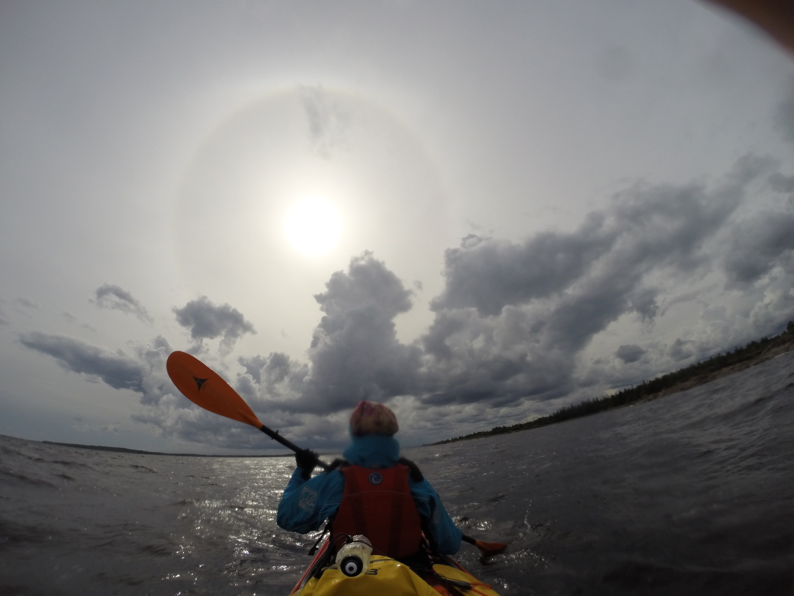
Day 1Cape Tolstik
The next day we set off at 8:20, somehow inexplicably starting the tradition of leaving at 8:20, which we kept up for more than half the trip — and we hardly even looked at the clock.
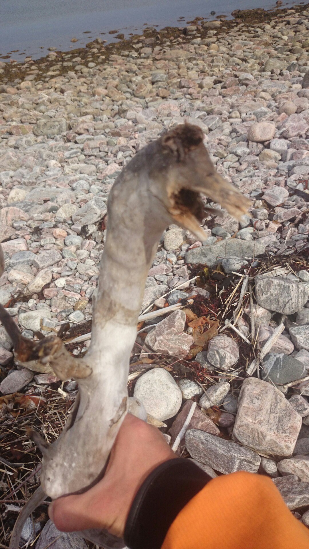
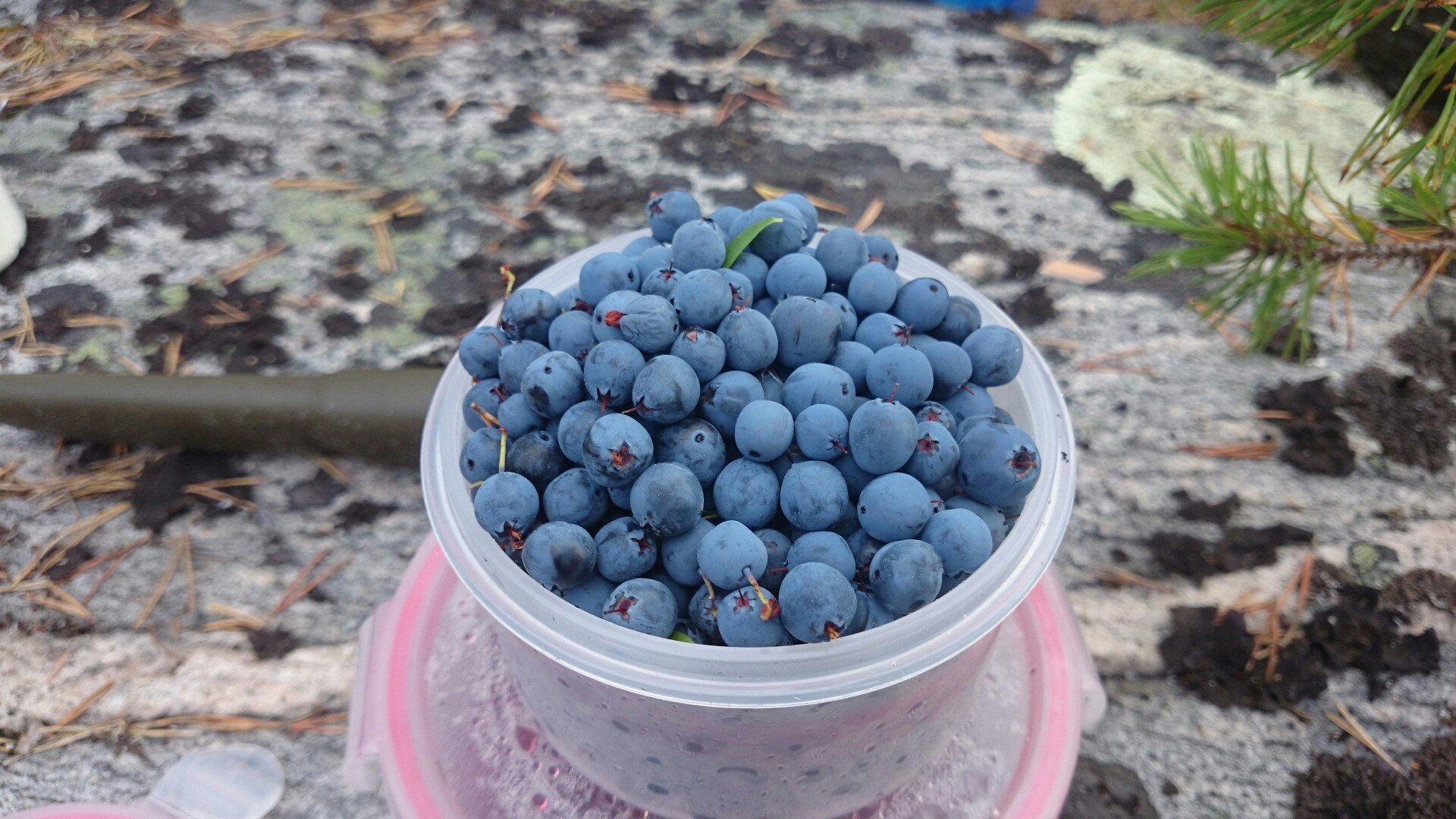
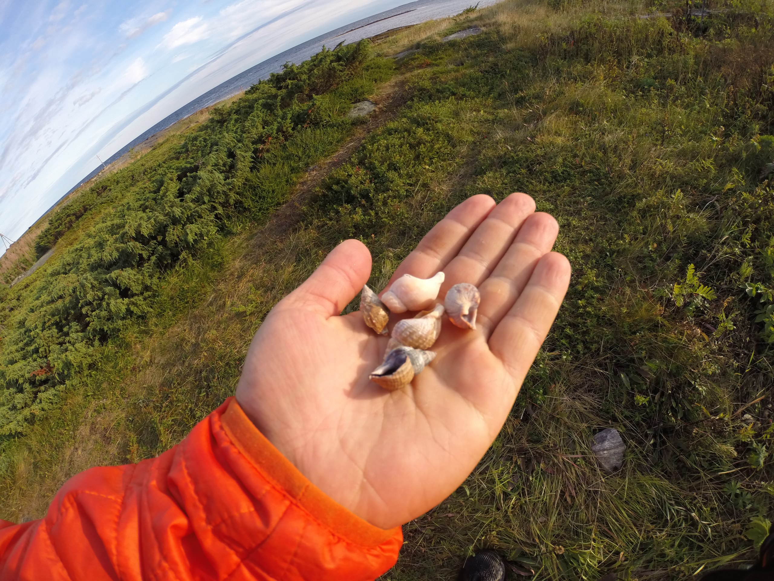
A moderate headwind blew, it was raining, visibility was heavily limited. Before lunch we covered 16 kilometers, stopping on Chernetsky Island near Oleny. The first thing we found was a huge amount of bilberries, and also how quickly the incoming tide devoured the low-tide zone — we constantly had to run and move the kayak.
After lunch, around 3 o'clock, the weather improved slightly, and we reached Cape Tolstik, rounded it and stopped at some unexpectedly great campsites sheltered from the wind off the sea, near a source of fresh water.
Fresh water was one of the things we worried about before the trip started. A plus of the White Sea is that thousands of little rivers flow into it, there are lakes and bogs along the shore, and after rain, pools of fresh water collect on the rocks. We always carried 1 liter of water in bottles with isotonic drink, 1 liter in a thermos, 2+4 liters in bladders, 2 liters in a hydration pack and 4 liters in a bladder that was our emergency reserve, which we luckily never had to use — 14 liters total for the two of us. As practice showed, our full supply of water would have lasted us a full paddling day — breakfast-lunch-dinner-isotonics-thermos plus breakfast and lunch without thermos and isotonics on the second day, all that without the reserve, and that's with us not using salt water; with it we could have raised our level of self-sufficiency a bit, but as it turned out, there's no need.
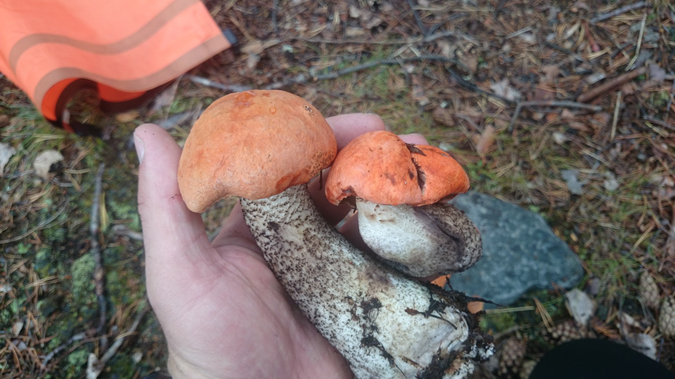
While I went for water, I gathered mushrooms, which we fried right away. In the evening there was a pleasant calm on the sea; we watched a group on catamarans use a sail made from a tarp to reach Oleny Island — apparently even small gusts of wind were enough for them. The exposed littoral zone hinted that we should set out at high water.
Covered 25 km.
Day 2Keret Island
We woke at 6 a.m.; while we cooked breakfast, I pushed the kayak along after the retreating water. We'd start our days this way until roughly the middle of the trip. It lets you set off at almost full low tide and travel on the incoming water. There are two pluses to this: the tidal current, and camping either at full high tide or at the start of low tide.
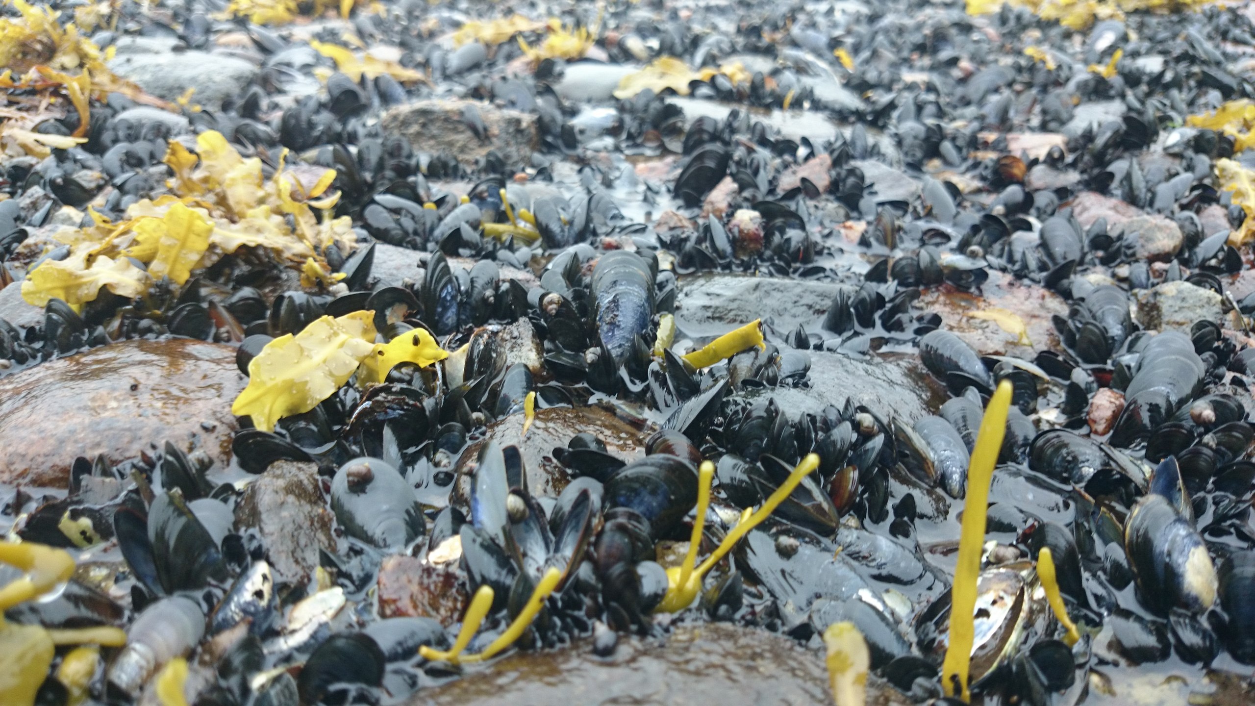
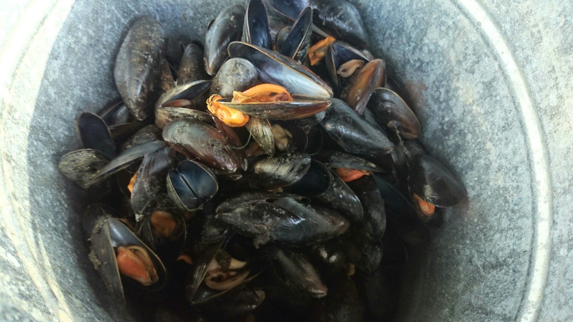
A very strong headwind blew; we made 3 km/h at best. A struggle like that is exhausting, and we stopped at Bolshoy Gorely Island for a breather, then crossed to a small islet next to Keret Island. We landed, found a catamaran crew's campsite. Nothing to be done — a very strong wind was blowing — so we rested, gathered mussels, lit a fire.
I used to have a poor attitude toward campfires in general, but on this trip the fire-building skill, entirely absent in me, came in very handy: we cooked on the fire a little, but mostly warmed up and drove off the midges. The only hard part was getting a fire going from damp wood.
When the tide came in we headed toward Keret Island; a small crossing took a heap of strength. We landed on a cape and went to look at the Bolshaya Salma strait. The wind was driving a genuine raging river out of it, so we relaxed and looked for a campsite.
We found one quickly; tourists on motorboats, right in front of us, vacated an excellent spot in the woods and even left us a fire with firewood. We sat on the shore and through binoculars watched groups in kayaks and on catamarans, coming out of the Keret River, get caught in the current we'd hidden from. They were immediately pressed against the shore and had to paddle with all their might perpendicular to it to get around the cape at all.
Over the day we covered 5 kilometers; it's raining. The only thing warming us is a good forecast for tomorrow.
Day 3Sonostrov
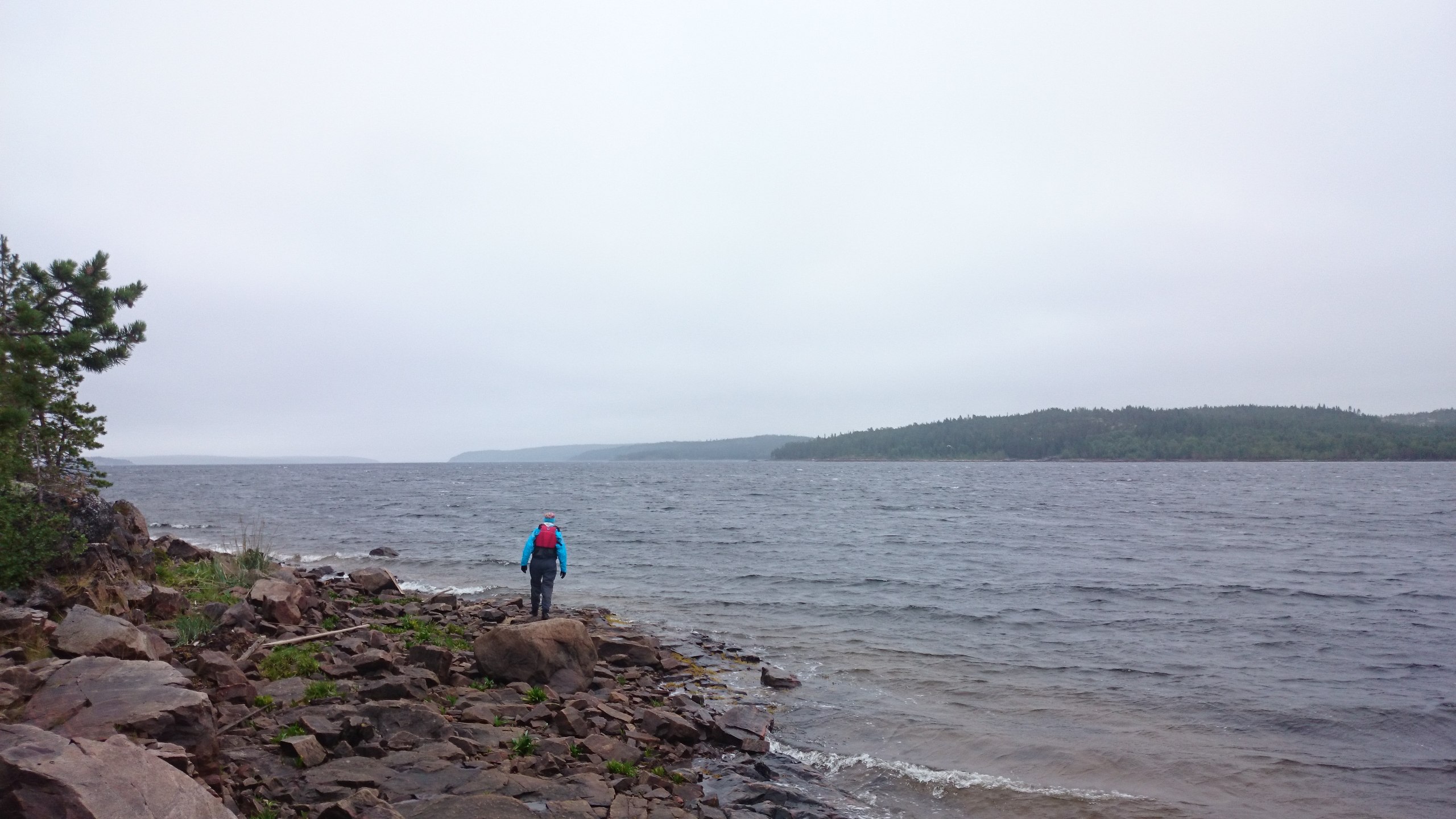
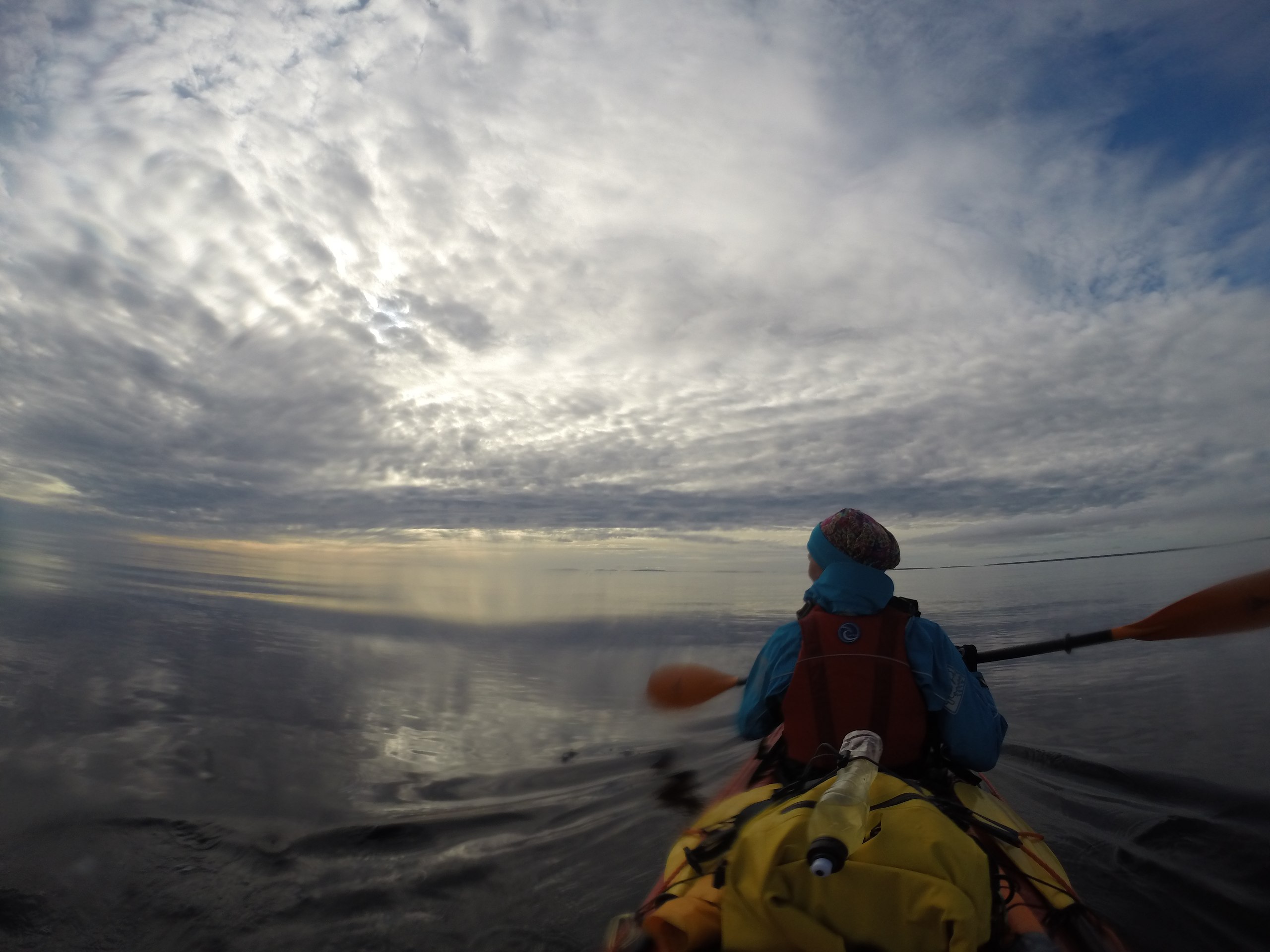
The forecast held up; in the morning the wind shifted from easterly to northwesterly. We head out into the strait and the wind and current carry us along at 8 km/h. We see the horizon and feel the long sea swell. Everything is going just splendidly.
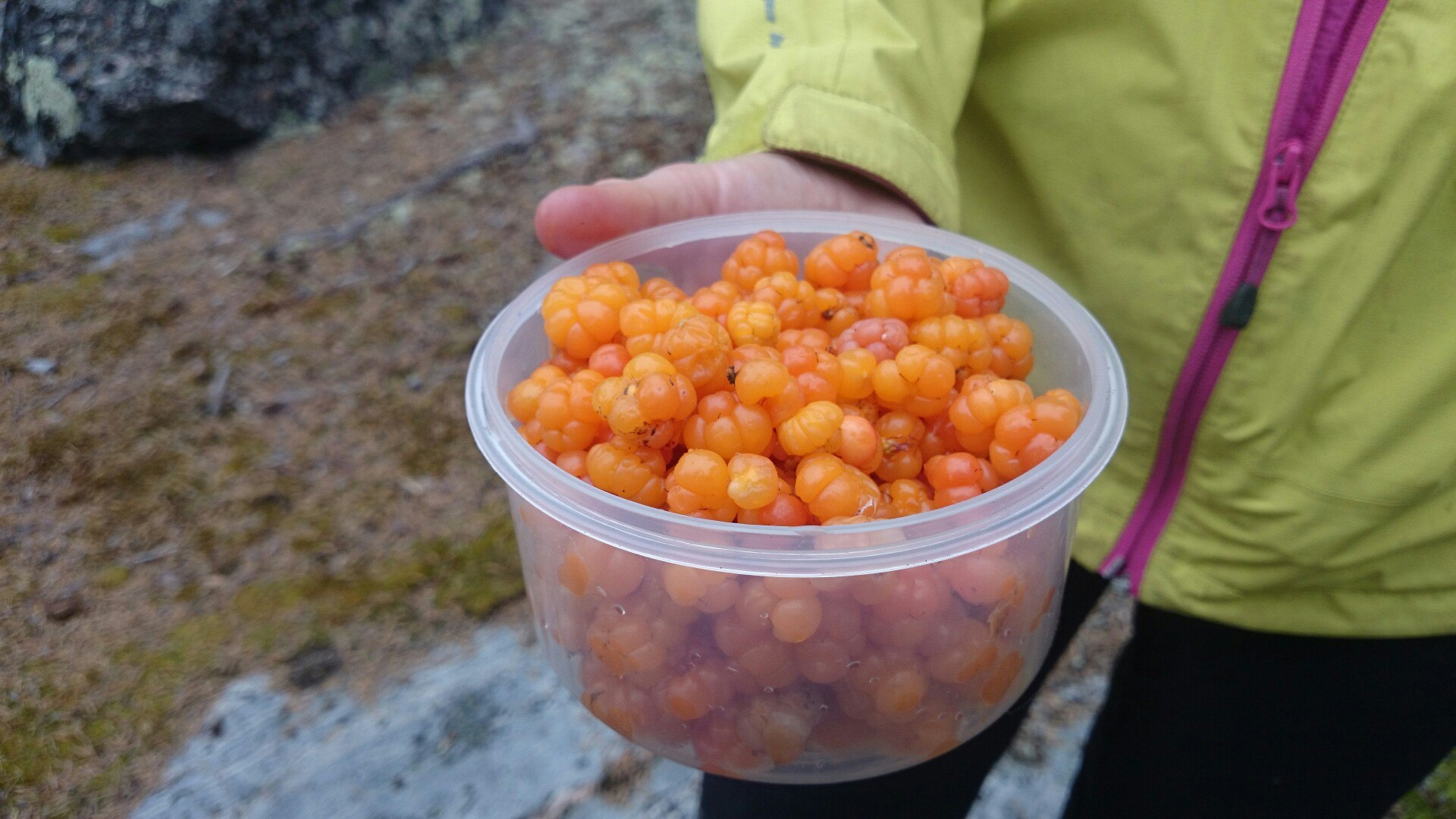
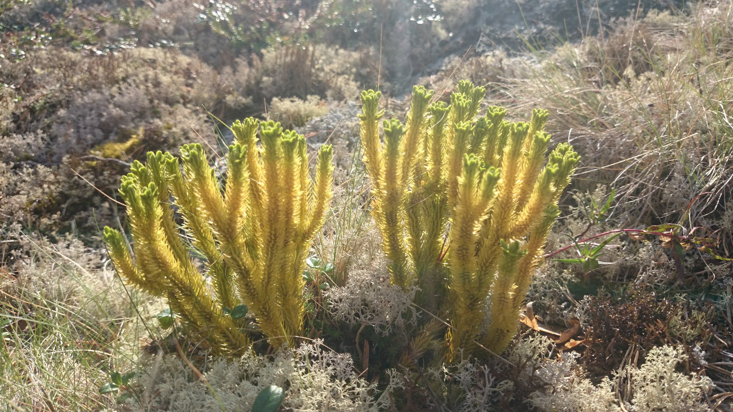
We stop at Cape Zhemchuzhny to fetch water and find a group of fishing huts clearly built for tourists. It's all too tidy there. We find our first cloudberries — there are few of them and they're small, but it's still very nice.
While rounding Cape Sharapov, the right rudder line snaps. At that very moment I happen to be thinking about why crosses stand on the capes, and in general I'm deep in thought about how important and sometimes hard it is to round a big cape. The kayak instantly becomes very poorly steerable, but fortunately I'd practiced correction strokes beforehand. The rudder lines on the "Ladoga" remain a mystery to me. They constantly chafe through no matter what you do, and on this trip, apparently because of the increased loads from wind and waves, the lines had to be replaced after every paddling day. I knew the lines were the weak spot of our boat and took a heap of spare Kevlar cord, rigging it so that if a line breaks you only have to replace part of the cord rather than its whole length. But one way or another, I have questions for the design engineers, and they go as follows: "what the hell."
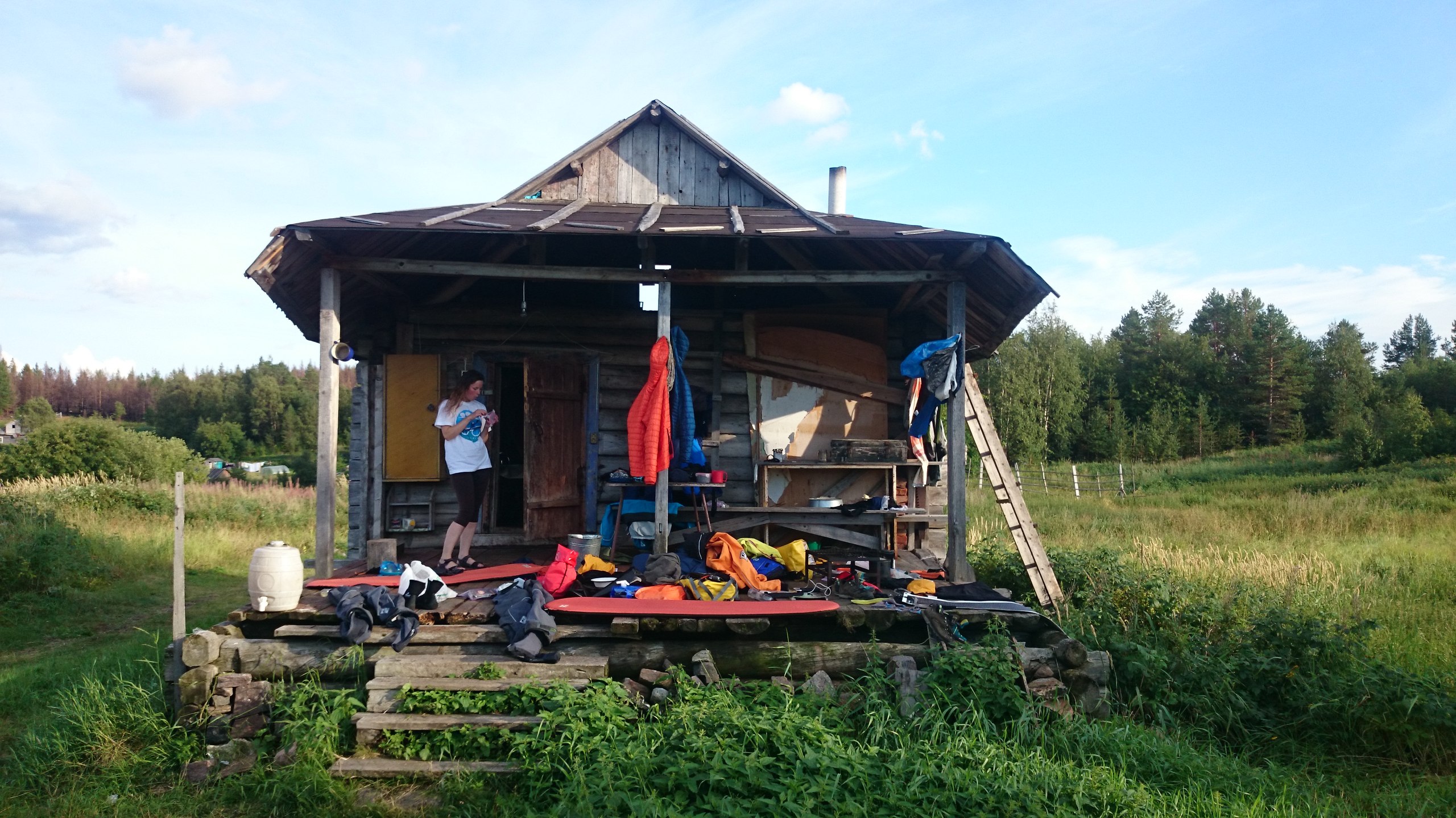
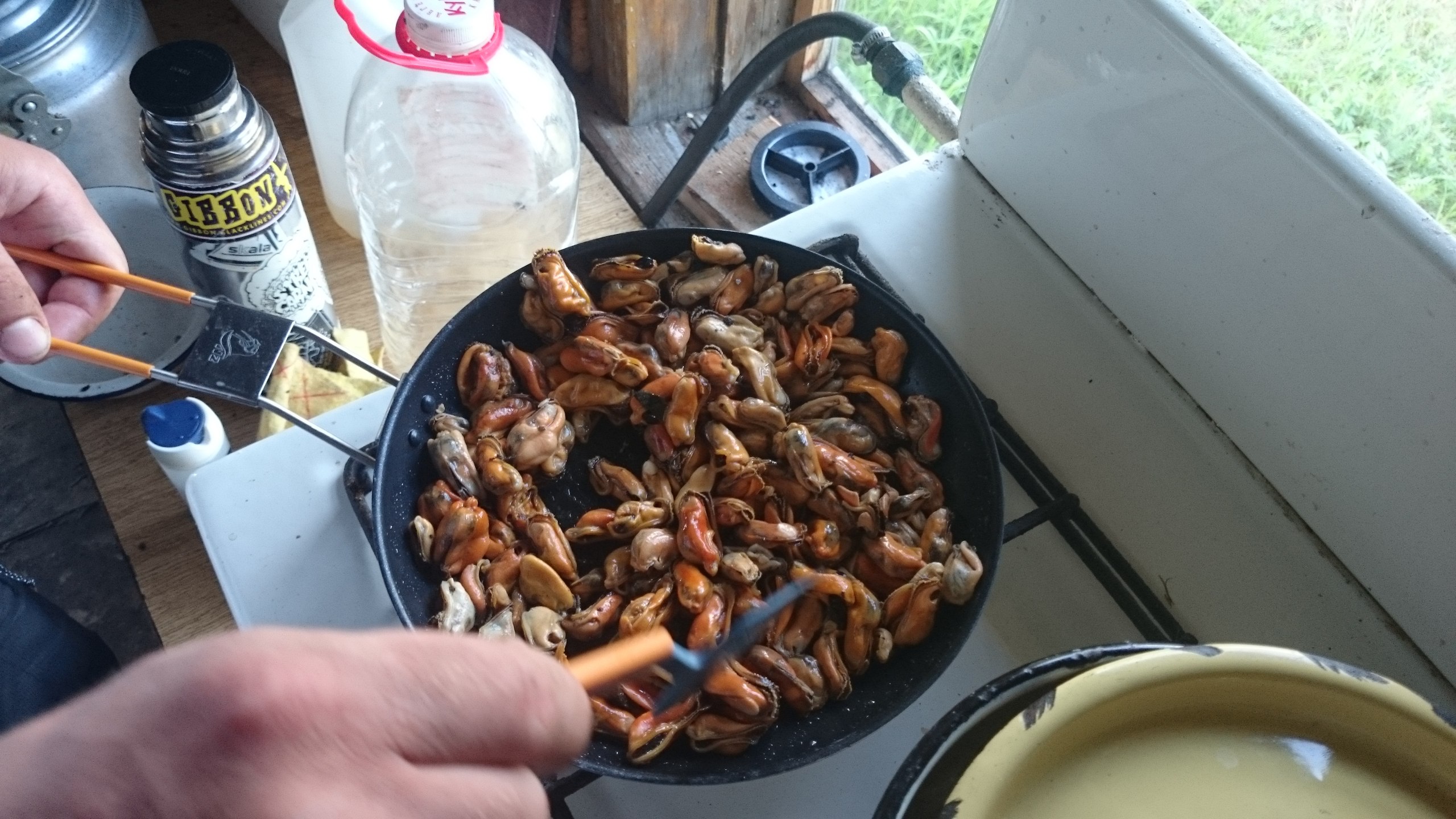
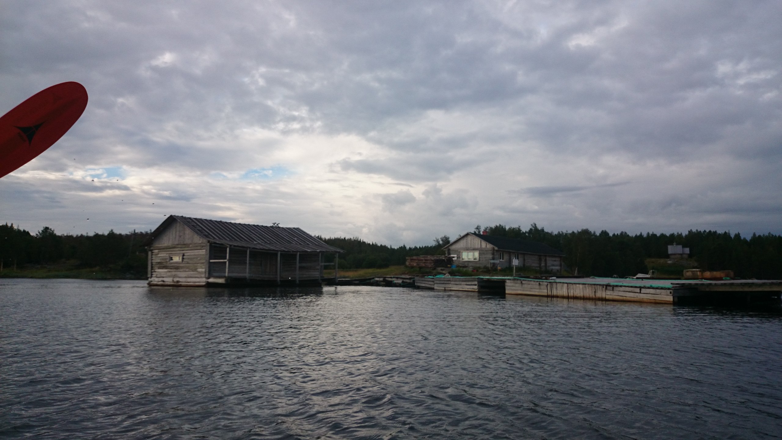
We have lunch beyond the cape, where we find a source of fresh water and wild peas. After lunch the going is easy. Around Sonostrov I spot something resembling floating pontoons and recall that, according to one of the reports, there should be a mussel farm somewhere here. My guess proves right, and we moor at this farm's pier. We stay in an old village cabin that Sergei, a local farmer, has adapted into a guest house for fishermen.
The main plus isn't the exoticism of a village cabin but the hot water left over in the banya. We gladly wash and launder our clothes while everything we couldn't dry yesterday dries on the veranda. It's interesting how the rather modest Pomor flora, on the site of a former village, gives way to almost the nature of central Russia: a riot of meadow grasses, even raspberries growing, which we immediately gather into a plastic container. We use the containers for berries, and it's already becoming clear we should have brought more of them — there are a great many berries.
The solar panel delaminated. It was actually advertised as a panel for yachts and kayaks, so water getting into it and subsequently destroying all its innards is a fail.
Sergei shows us the forecast from the Norwegian site yar.no; by it we have 3 days of good weather ahead, after which the winds shift from northwesterly to southeasterly and easterly. Sergei's wife treats us to cucumbers and tomatoes, we finish off the huge mussels they raise here, and contentedly go to bed.
Covered 35 km.
Day 4Olga Bay
Good weather in the morning; we set off at 8:20, a pleasant tailwind quickly carrying us forward. An hour later clouds begin to fly past, spilling rain onto the sea. Another couple of hours and we notice a big, unpleasant-looking front forming behind us, thunder rumbling.
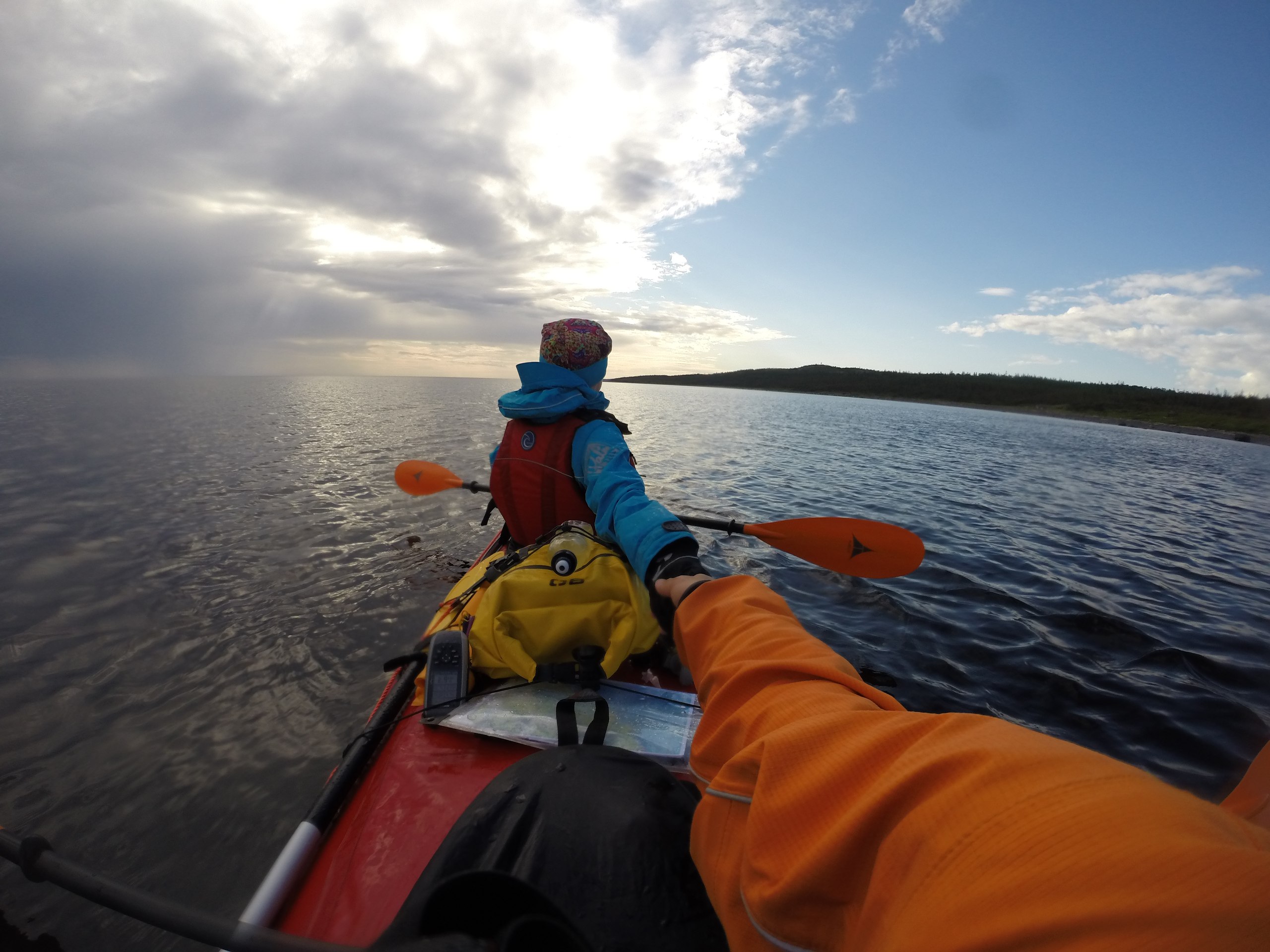
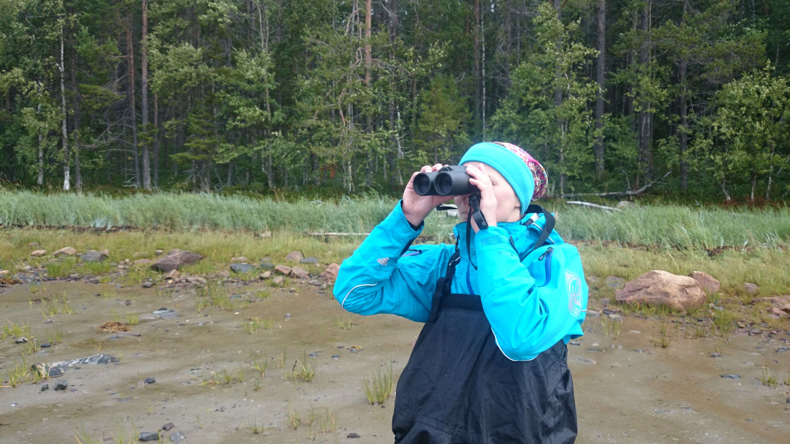
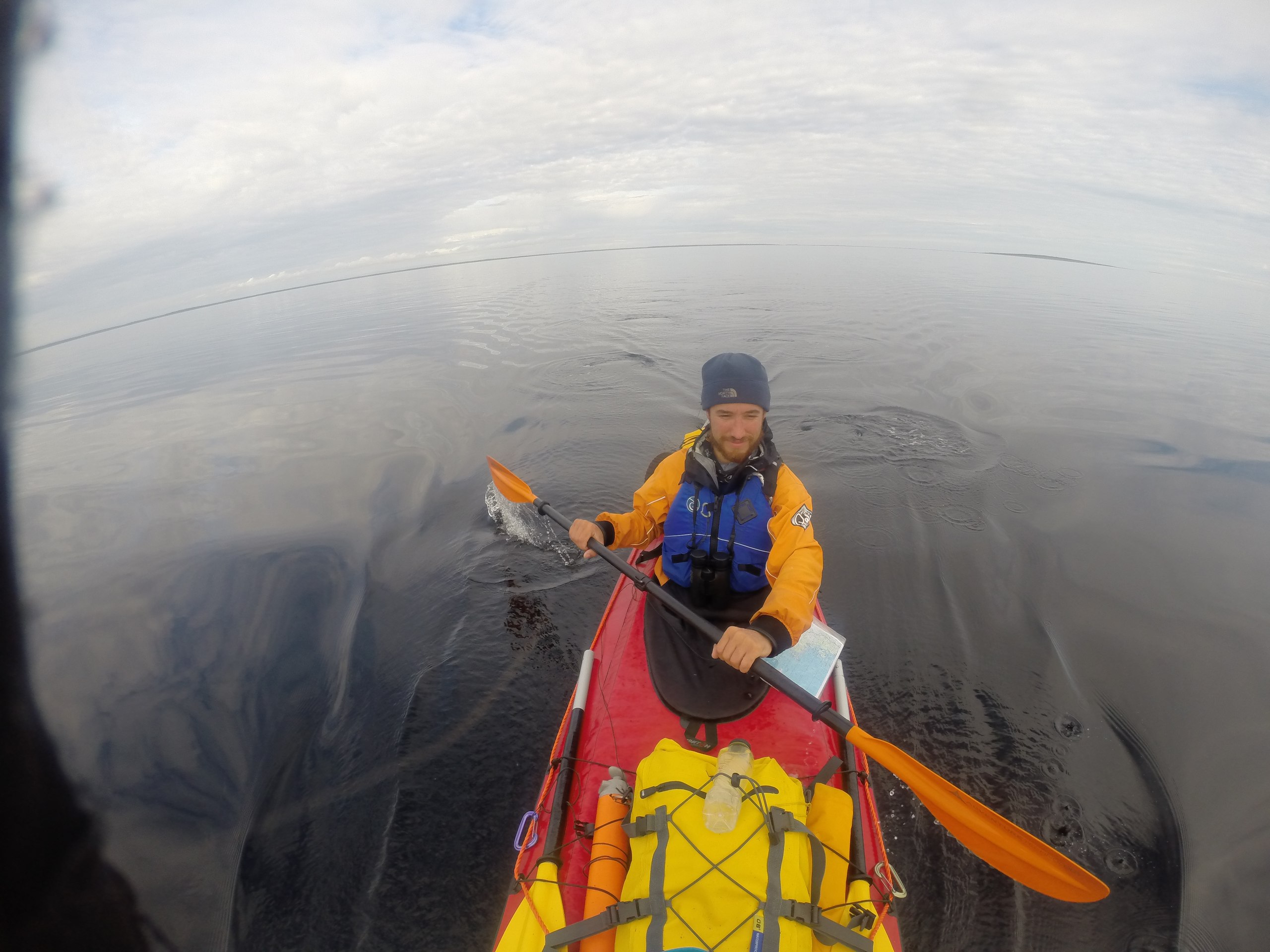
We see belugas for the first time; it's fairly deep here and they feel comfortable. They travel singly or in pairs; once one even swam up quite close and we heard it exhale. A very beautiful sight. The binoculars help us see them better. In general it would have been less fun without binoculars.
The wind off the land strengthens, and whereas before it had helped, now it drives a short wave and gets in the way every which way. We stop for lunch beyond Cape Cherny Kamen, which we barely paddle up to against the wind blowing off the land.
An excellent sandy beach is a substantial bonus of this spot. We go to scout a fishing hut, in which we find Maxim from Gridino, a fisherman, who treats us to tea and bread from a village oven. He complains that there's no work here and he has to poach.
We finish lunch and notice the front moving out to sea, with a tailwind following it. We jump on it and make the crossing of the bay. The going is fast, but you can't relax on a strong following swell; the wind keeps trying to turn us along the wave. But that's a fair price for a speed of 6–7 km/h.
After that the going is fairly fun, but the wind changes direction and we're pushed away from the shore again. Approaching Cape Purnavolok, the left rudder line snaps; again we go without a rudder. We stop in a bay before the cape and make repairs. We meet kayakers who'd run one of the rivers and are now waiting to be picked up at the cape. They recommend campsites in the bay, but there's no water at them, and we badly need it, since the next day we'll be resting.
We round Cape Purnavolok and Cape Kirbey, run into a strong headwind, paddling into the sun. On the map we found a spot with a stream in a small bay; by all accounts there should be good campsites here. We go by instruments, since nothing is visible. Our instinct didn't let us down. We land at a wonderful spot with a sign reading "Olga Bay." The sign is visible from the water, but reading the inscription proves impossible.
The bay has the full set: equipped campsites, berries in abundance, shelter from the wind. The only downside is that the nearby stream has dried up, so to get water you have to bushwhack across the tundra with a heap of rocks and bogs. And bear scat everywhere on top of that.
While looking for water, I find a clearing of cloudberries, and also a pile of bog bilberries. The bog bilberries taste almost like regular bilberries, but unlike them they don't smear, so now we gather only those.
There are a great many signs of bear activity, and we decide to remove all the food from the kayak and put it well away from camp in dry bags. Our reasoning: better to lose only the food than the food and the kayak.
The village of Gridino is nearby, and our idyll is disturbed every so often by the noise of yet another boat's motor.
Covered 37 km, passed the 100 km mark.
Day 5Rest day
The first rest day, but we only managed to rest in the sense that it was a change of activity. In the morning, 3 kilometers for water (because of the water, larger groups would do better to camp farther north, closer to the lake), then I gathered firewood all day; there's a lot of deadwood and driftwood washed up on the shore here. In general, over the whole trip we cut nothing and burned only what we could find.
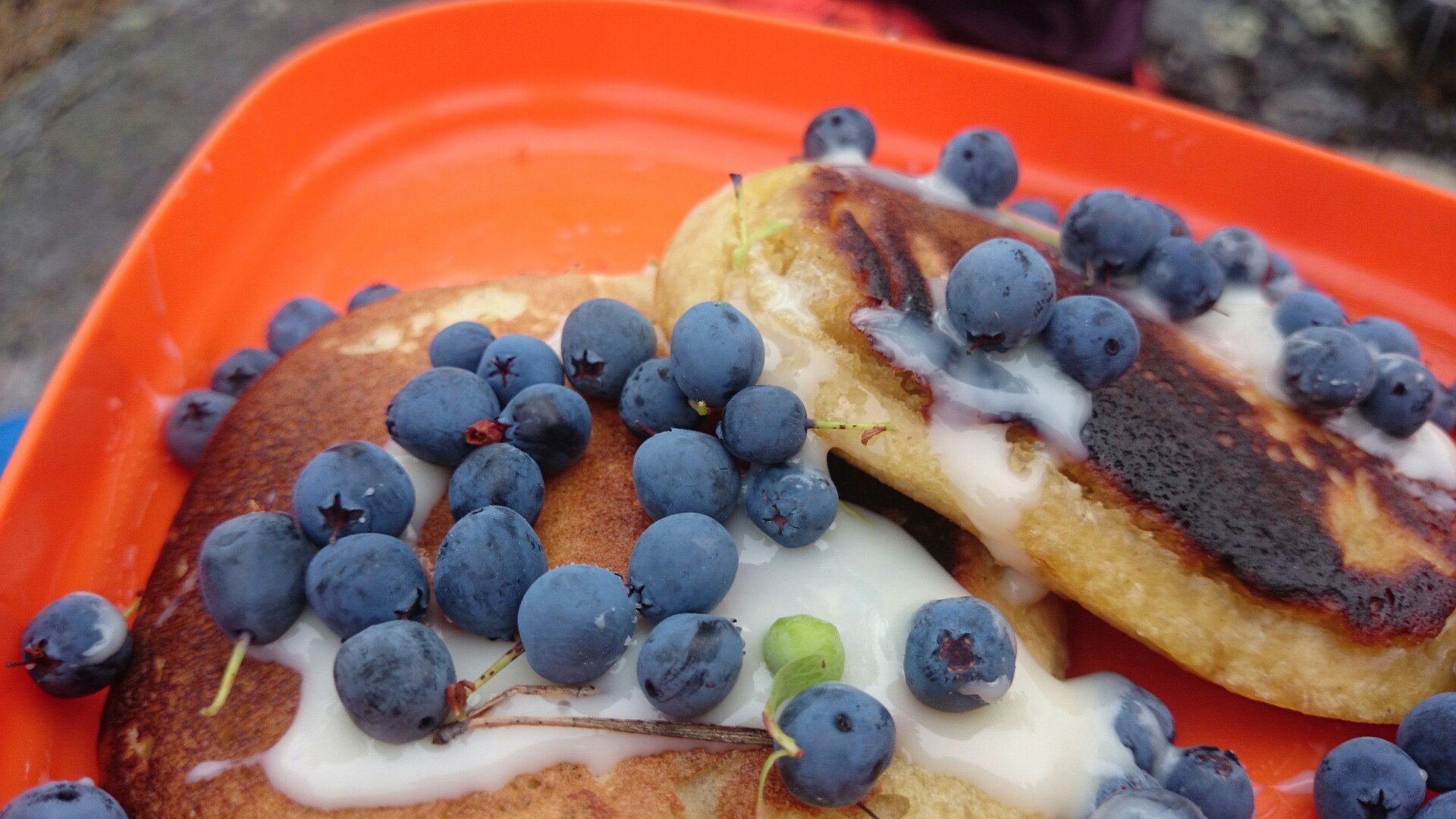
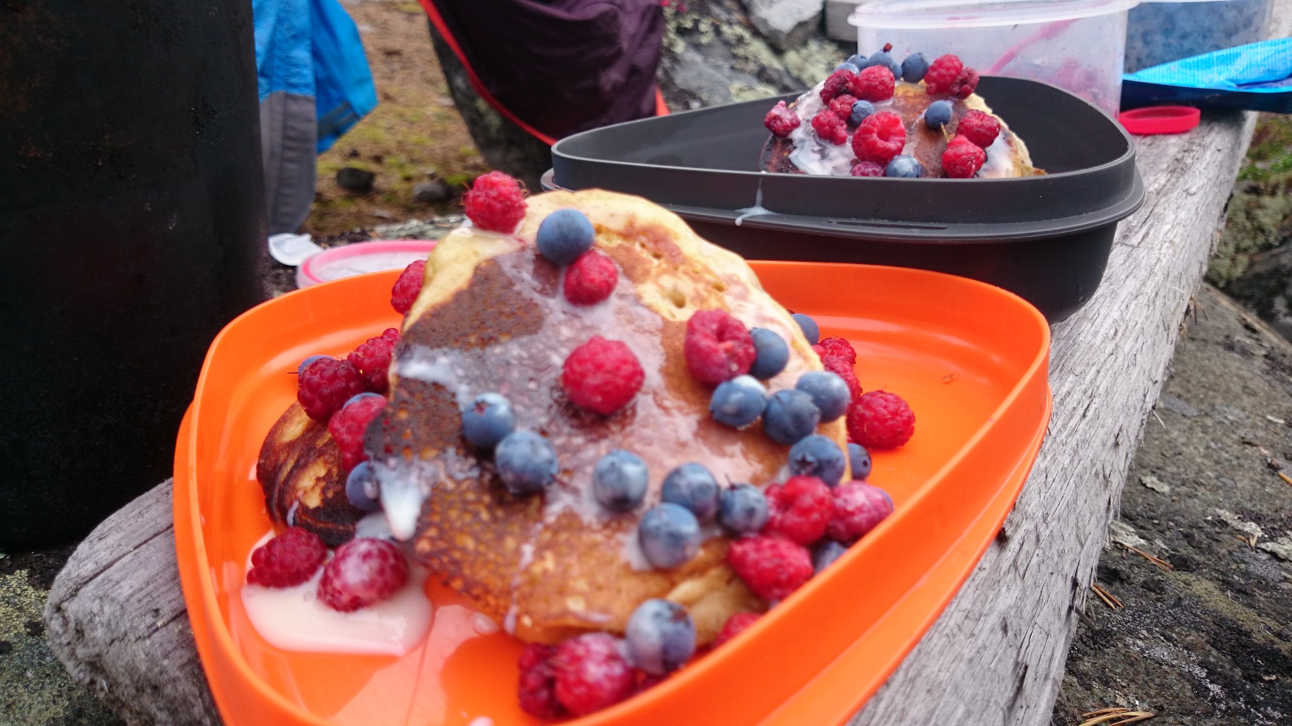
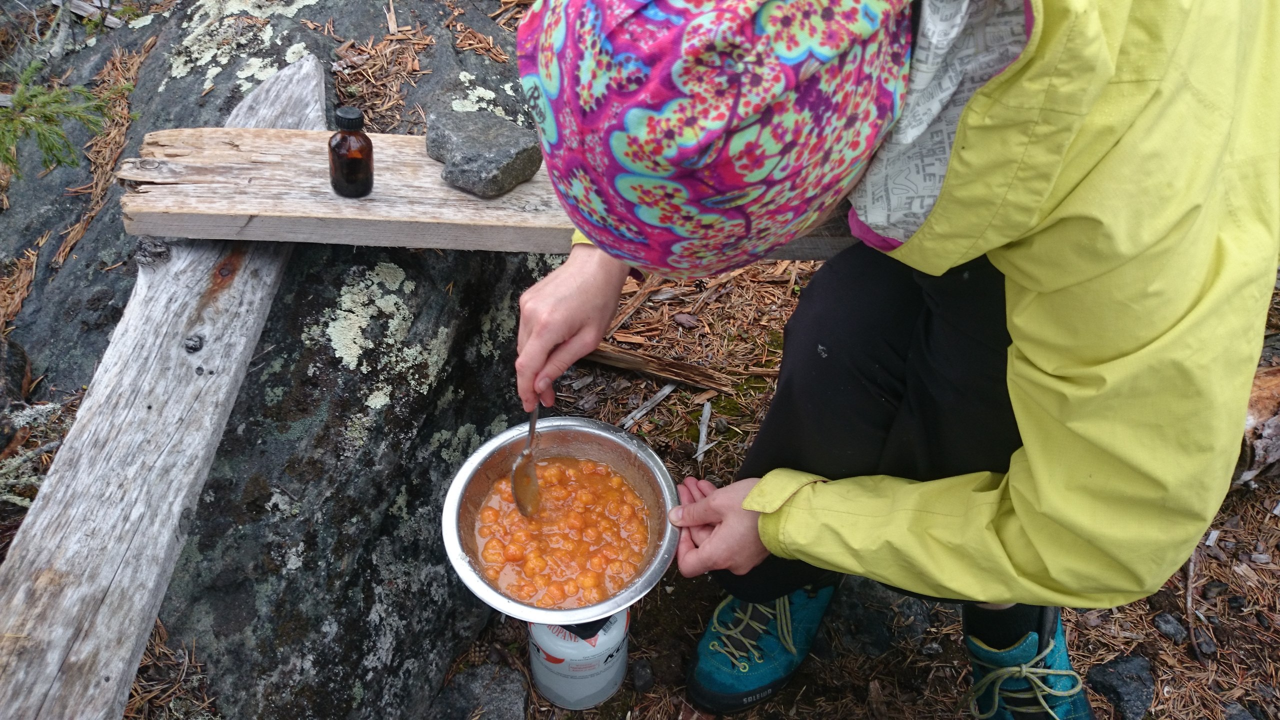
We gathered cloudberries and boiled up jam; Dasha baked pancakes. By this point it was starting to feel like we were on some kind of gastronomic journey.
A bit about food storage. Everything, of course, in little bottles and jars. Milk bottles with a wide neck are very handy, but special mention goes to the little bottles Russian Railways hands out water in on the sleeper carriages. They're small, wide-necked, very handy for keeping a working supply of dried vegetables in or soaking lentils, for example. Actimel bottles, wrapped in cling film, turn out to be watertight, so everything stays dry.
Only the jar of dried tomatoes leaked. Before that we'd long wondered what was tinting the water that got into the kayak a reddish-yellow color. The water, by the way, mostly got in because the sea socks leaked slightly; the hatch had leaked earlier, but sealing tape for the windows solved that issue.
I dug up some lugworms, tried to catch cod, but only set aside half an hour for it in the evening, and it's somehow quite shallow here. I decided to drop it and try later (spoiler: later there was no weather, and then no desire either, so I didn't fish for cod at all).
The tide schedule we'd been told about in Chupa (water comes in for 4 hours, stands for 4 hours, goes out for 4 hours, stands for 4 hours) stops working. The ebb is long, the flood is fast.
The valve on the water filter failed; I couldn't figure out how to fix it, so now it's boiling only. The water is brown and boggy almost everywhere. You're lucky if you find a clean puddle.
Day 6Korgi and ludy
We set off at 8:20 on an almost full tide; in the morning we make the crossing of Gridina Bay, a little over 10 kilometers. A tailwind let us do it in under an hour and a half.
According to the map, after Gridina Bay the korgi and ludy began. Korgi, in the Pomor tongue, are shoals, and ludy are small islets that the tide may well cover with water. We came up to them right at low tide. We stopped on an islet and looked around. Before us opened a labyrinth of rocks of various sizes sticking up out of the water. We started off briskly and ran onto a rock lying 5 centimeters below the surface. We went more carefully.
Navigation among the korgi is very difficult, and it's especially unclear where you can pass. The maps came partly to the rescue. I used the General Staff 1 km sheets and the GGC 500 m sheets on the Garmin. The korgi were marked much better on the 500 m sheets, but even so many things, such as passages, were unclear until you came right up to them and confirmed that the passage in question wasn't there.
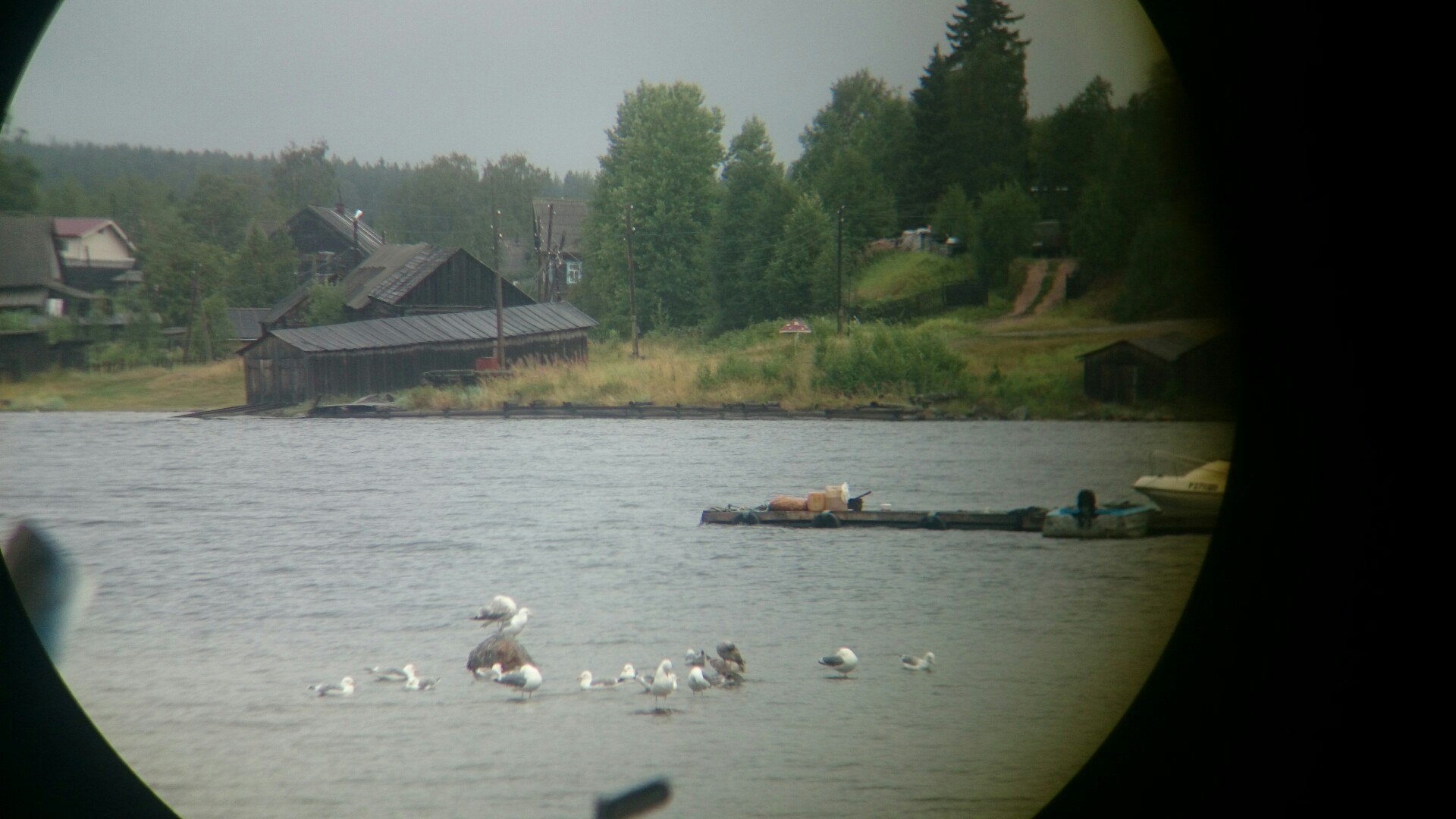
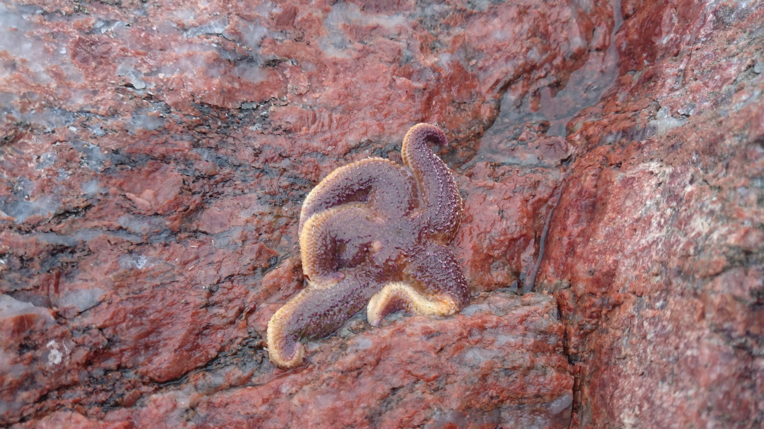
The stretch of coast south of Gridino is already wilder; we don't meet a single boat, but we do meet our first seals and bearded seals — lakhtaks. From afar they look like very smooth rocks. They sprawl on the korgi; spotting us from a distance, they spend a long time deciding what to do, but the result is always the same: they comically flop into the water. Sometimes they surface now on the left, now on the right, studying our quiet vessel from a respectful distance.
We had lunch on a nameless islet with a triangulation marker near Salnye Korgi. Before that we even had to make a short portage, since we couldn't get out of the labyrinth without going out into the open sea, where a strong wave was breaking.
After lunch, having wandered a bit among the korgi, we approached the southern part of Nikonov Island and understood why everyone who'd done this route went around Oleny Island via the system of streams and lakes. The korgi are exhausting, but we'd decided after all to do a sea route, not some river one, and besides, rapids were marked on the map, which we didn't want to portage around.
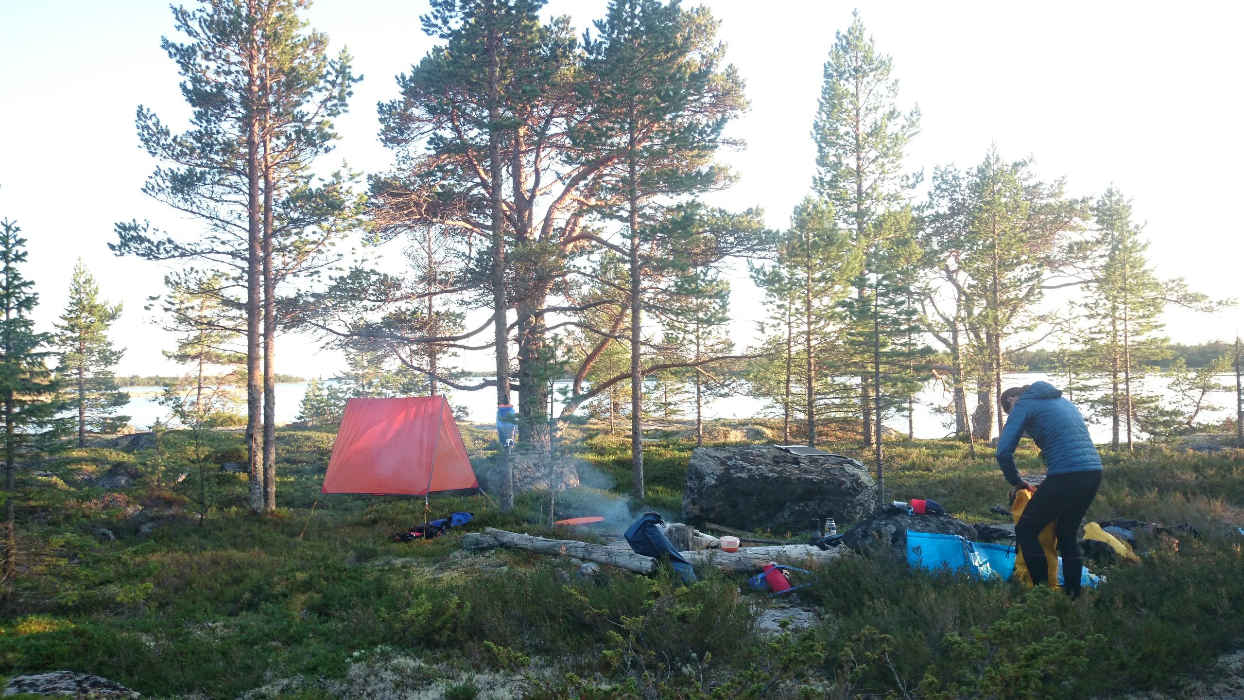
We chose a spot for the night in a little bay north of Berezhnye Lekhludy. Everything was excellent: wild nature, no spots for a tent, and only a couple of rocks for a little fire.
On the plus side: excellent stone slabs onto which the kayak is easy to haul. For the first time we were camped in the wilds, and there was a charm in that. The downside was that we struggled to find a way to pitch the tent somewhere other than on the bilberries, and it was also unclear where the fresh water was here, but we were very tired and decided to use the supply we had.
At 2 a.m. cranes woke us; in the nighttime silence their voices sounded eerie.
Covered 37 km.

Day 7Syrovatka Island
We decided to set off a bit later, so as to cross the korgi at low tide and cross Kalgalaksha Bay already at high tide. The wind is a headwind or head-cross wind; the going is not easy, and the Sonostrov forecast no longer holds. We start on very pleasant flat water, get around the korgi relatively easily. At low tide they're actually easier to pass, because everything is clearly visible. When we come out past Cape Solomenny, it turns out I've somehow managed to break my phone; now it's no longer waterproof, and I can't use it as a camera — an annoying loss.
We had 2 plans for crossing the bay: the reckless one and the cautious one. The reckless one involved almost 20 kilometers of open water, but we saved it for good weather. The weather was not great; a strong wind off the sea let us neither speed up nor relax. The cautious plan assumed we'd go straight into the bay, making a detour. We decided to choose something in between. From Cape Solomenny we headed for Cape Parusnitsa, ultimately correcting our course to Cape Vyshkov.
The crossing took 2 hours; toward the end the waves were already washing over the kayak. We stopped to rest and have lunch, and discovered that the fishing hut on the cape had long since collapsed. As always, we decided to wait a bit after lunch for the weather to change. From the third day of the trip a pattern had emerged: in the morning little clouds rose over the land, by lunchtime they were carried out to sea, the wind strengthened, but after lunch the wind died down a little. This time it went roughly the same way, except the little clouds brought with them local fronts with rains that seemed to drench everything around except us.
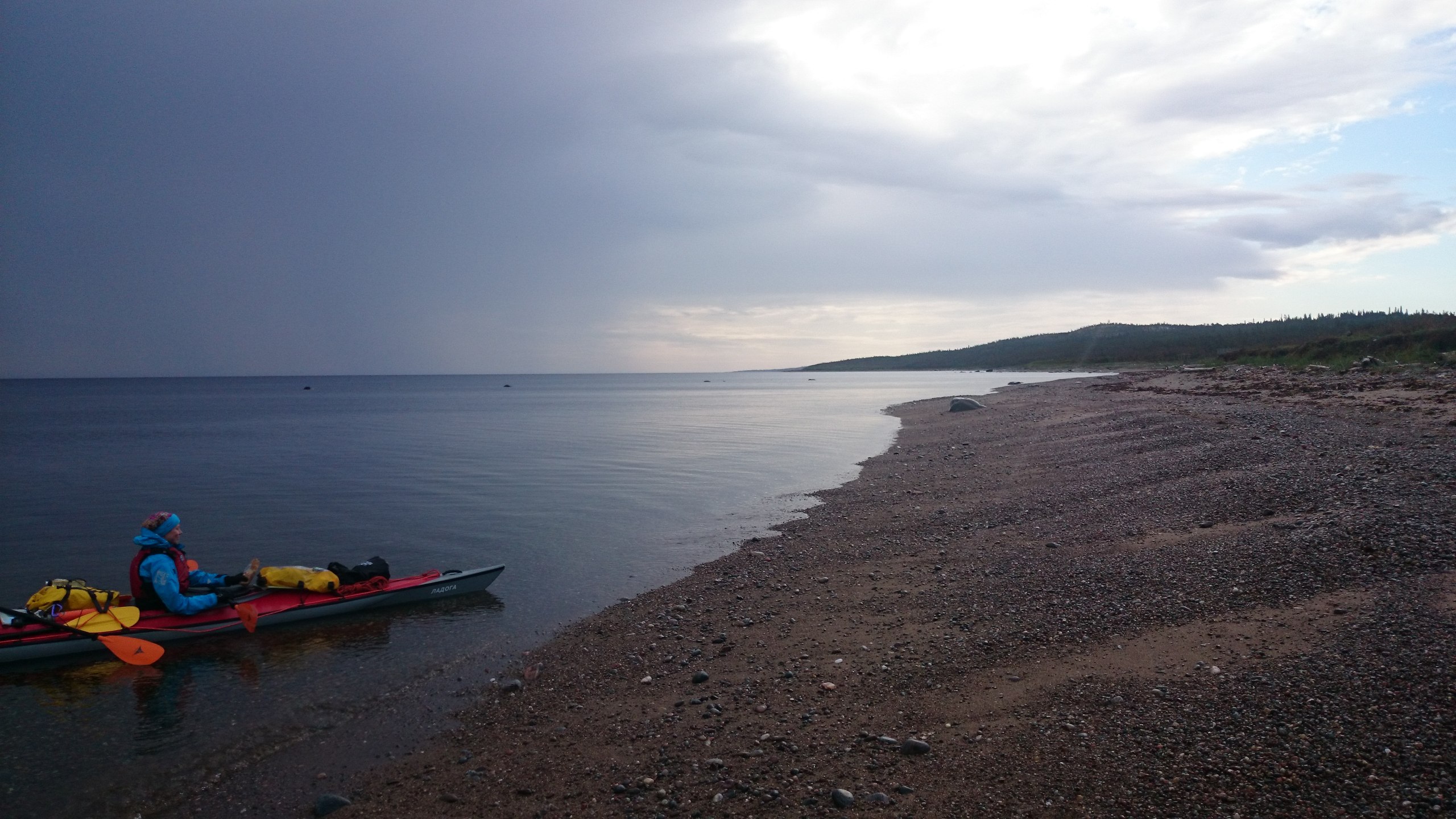
We reached Cape Kamenny, whose hut had been taken by a group with a catamaran, rounded it and saw a simply appalling littoral zone. It stretched for hundreds of meters and was a perfect visualization of the word "hopelessness." There were basically no campsites; everything was waterlogged, the whole tidal zone covered in wolf and bear tracks.
One of the local fronts came to our rescue. It brought a powerful tailwind with it; we didn't wait for a second invitation, and 40 minutes later we were at Cape Morzhovy, our next intended camping point. There we discovered a new labyrinth of islets; we were traveling at the start of the flood and they hadn't yet had time to sink into the water.
We still had strength left, the wind wasn't dying down, and we decided to jump to Syrovatka Island; it had a hut and in theory you could reach a spot with fresh water from it — we had only the reserve left, and the next day was to be a rest day.
We reached Syrovatka very fast, though the approach to it was rough. A strong wave was breaking on rocks lying underwater; we had to memorize every spot where the waves were breaking and weave between them, but even that didn't save us from running aground dead-stop on one of those rocks. In the end, 10 minutes later we landed and saw a boat with people by the hut.
These people turned out to be three geologists, who kindly invited us to ride along to the mainland for water. I went; Dasha set up camp; we came back and drank tea with the geologists. The wind was strengthening. Spending the night on an islet is, in my opinion, the best thing kayaking can offer. A small patch of land, and it's all yours. Incidentally, on the island we found a puddle that rainwater drains into; that covered all our fresh-water needs — we filtered and boiled it and even gave ourselves a shower.
Covered 38 km. Not the easiest day.
Day 8Rest day
A strong wind blew in the morning; by lunchtime it got rather hot. We dried out our things, and once again I changed the rudder lines. The geologists, meanwhile, walked around the island, tapping with their little hammers, collecting samples.
We decided to actually rest and reduced our activity to seal-mode (lie around, sleep, eat). A review of the gear showed that the GPS, which had worked flawlessly for 7 days, had taken on some water and was now barely alive; a little later it died completely. By the way, this is a marine GPS, waterproof. The battery block, lying in a dry bag inside a dry bag, also gave up the ghost. It was a shame to lose the whole track, as well as the ability to charge the remaining electronics at all. Luckily, there were spare batteries for the GoPro. We now decided to track via the Suunto and charge using the Goal Zero charger, into which you can put simple batteries and charge devices with them.
It's interesting that on this trip we successively lost the ways to charge electronics, and then the electronics themselves. It made me think about the necessity of all these cool and trendy devices. I was of course prepared for their loss, and everything was duplicated, but the thought that I'd become too dependent on devices and a heap of unnecessary data wouldn't leave me. The sea was teaching me an important lesson. Liberation from electronics opened my eyes even more to the beauty around us, and most of the time I focused on the meditative quality of the paddling process.
Toward evening Dasha made pancakes and we talked with the geologists until midnight; they turned out to be very interesting conversationalists. The geologists kindly shared with us the tide schedule for all the key points of the rest of our route. Outside the window the easterly wind strengthened, the waves grew, rain set in. We pitched the tent taut and lay down to sleep, deciding we'd see about the weather in the morning.
Day 9Yaichnye Ludy
The morning weather was no joy; the wind blew off the sea. We decided to wait for full high tide and travel along the shore to Cape Khennoy Navolok and take shelter there.
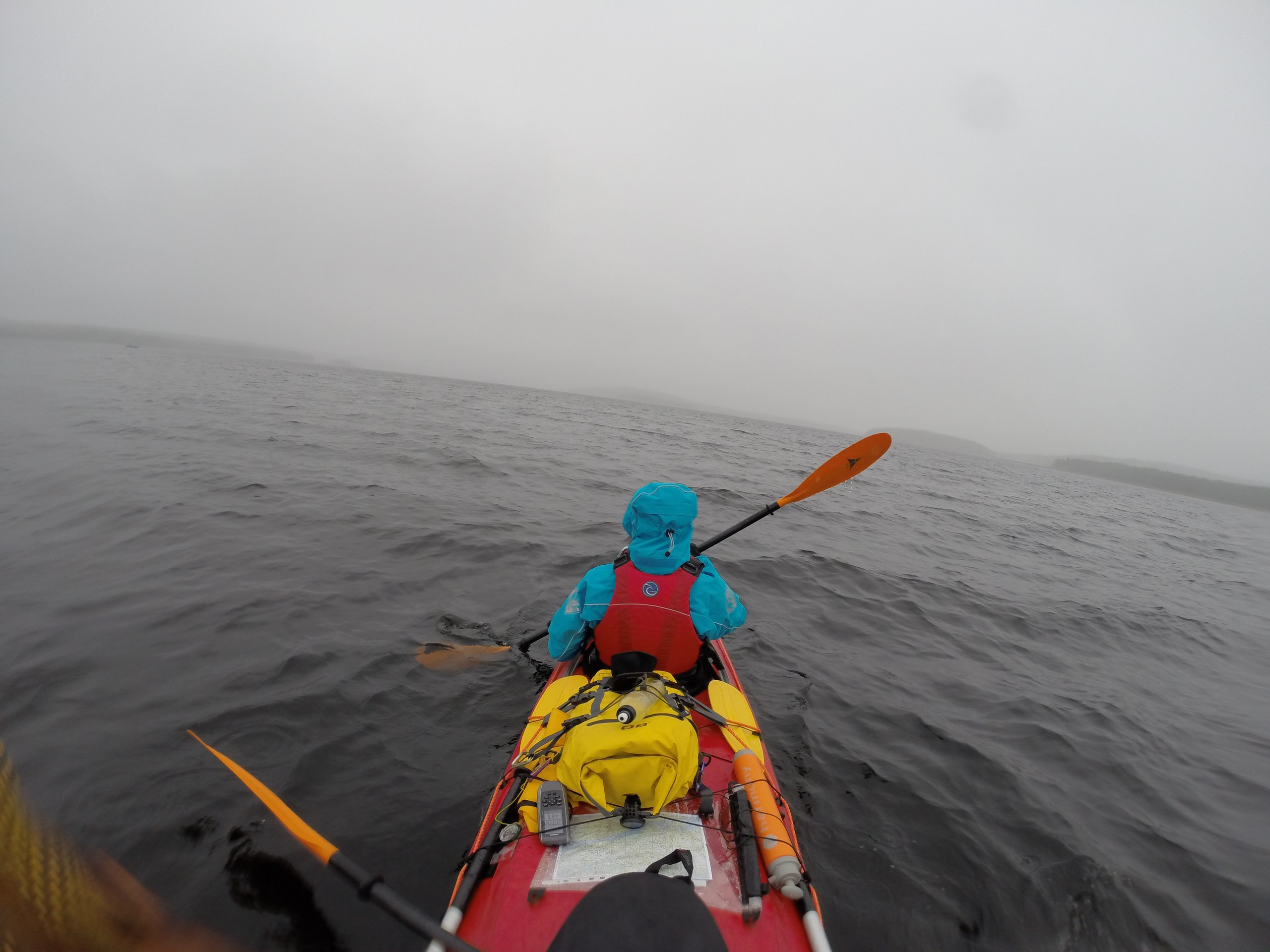
But our plans were a touch ambitious. We barely dragged ourselves to Yaichnye Ludy Island, and from it could reach only a fishing hut on a nameless cape, 5 kilometers in all. The hardest thing about paddling like this isn't the paddling itself, or even the waves washing over the kayak, but that a waterfall of spray is constantly flying at you — at least everything off the front paddler's blades flies onto the rear one, on top of what the wind tears off. And the battle of the paddle against the wind, comparable to the paddling itself, doesn't help much. You go slowly, you tire fast.
Day 10Stolbovy Islands
In the morning it seemed to us that the wind had died down and changed direction. After we set off everything quickly changed; we were fighting a literal wall of wind. We paddled up to Cape Khennoy Navolok with great difficulty. There we rested, gathered cloudberries, lingonberries, a few mushrooms.
We decided to go around Khennoy Island, waiting for the tide and passing between it and the mainland. True, we ran out of patience and started dragging the kayak along the channel that was forming, expending a lot of energy until we reached the island itself. There we caught our breath, had lunch, gathered more cloudberries and found water in puddles on the rocks.
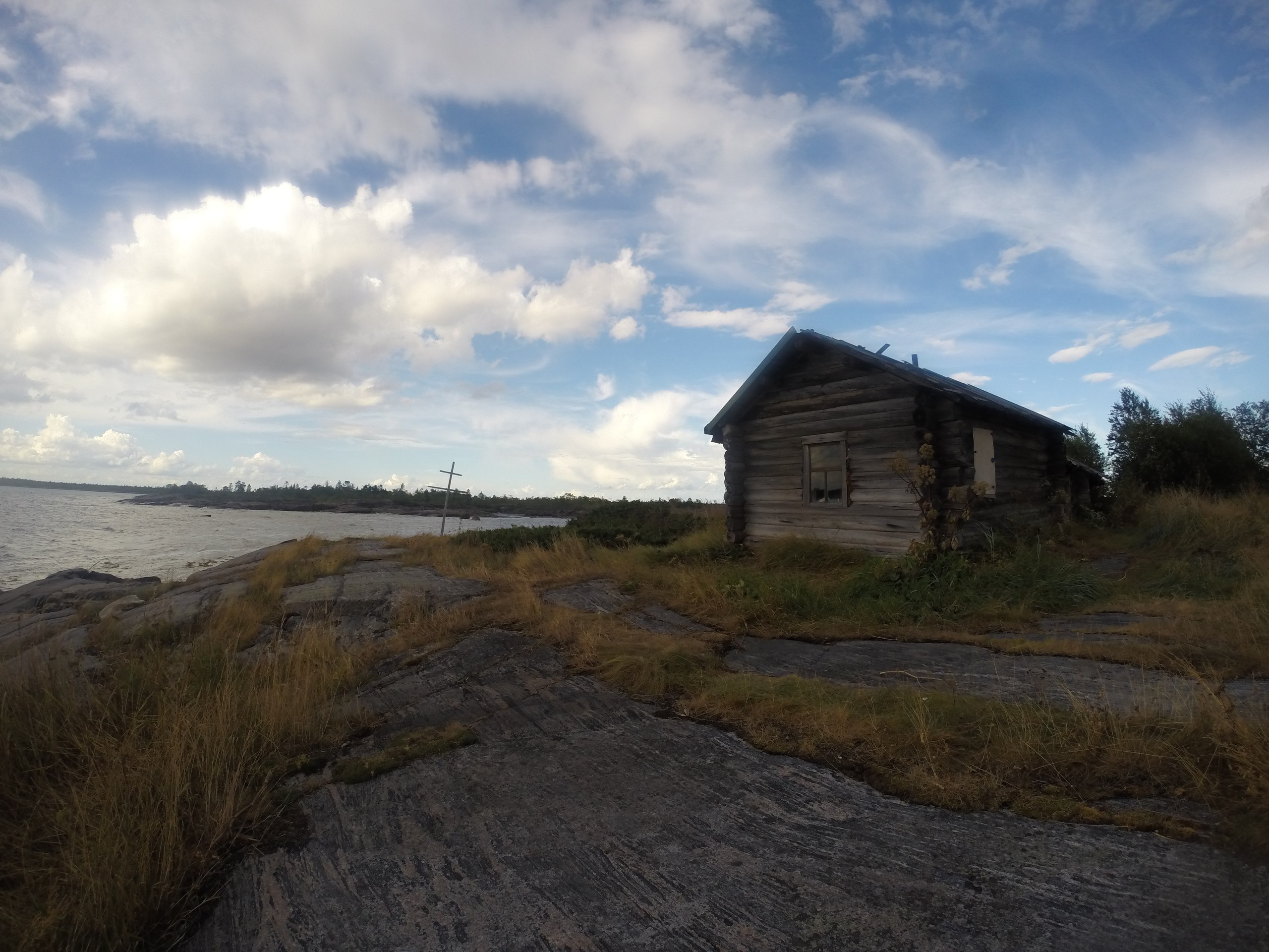
We decided to go on to the Stolbovy Islands; the geologists had said there was a good hut on them, but if it was taken you could camp on the neighboring island. 4 unpleasant kilometers later we were at the hut, which turned out to be empty.
A signal appeared; we called our families and friends, updated the group's status on VKontakte and made cloudberry jam. Toward evening the weather improved, only to worsen again.
Staying in huts is cheating, but in bad weather it's a big help: there's a table in the hut, you can lay out everything for lunch, study maps, hang some of your things to dry — but after a second night in a hut we already badly wanted our little tent.
A mouse ran around the hut all night and wouldn't let Dasha sleep; that said, a note in the hut had warned of the presence of "the mouse Kuzya." It also cautioned against giving him vodka to drink.
Covered 10 km. Very tired.
Day 11Chernetsky Island
In the morning the weather visibly turns for the worse. Morale is rock bottom; we think about how to paddle to Pongoma and end the trip there — by our reckoning that might take another 2 days.
We start paddling into a strong headwind toward the Solodushnye Islands, going 3.5 kilometers an hour, rain pouring down. But an hour and a half later the situation changes sharply. The wind shifts and begins to nudge us along slightly; we quickly come out of the ludy and make the crossing of the bay to Pongoma Island. Clouds gather all around, but we decide to risk it and jump farther. There's one more exit point off the route, the village of Letnyaya Rechka, and if the weather worsens we'll push on to it.
We give it everything, knowing the weather won't help us forever, and reach Bolshoy Medvezhy Island, where we have lunch near a fishing hut. The tidal current helps us go against the wind. The surrounding terrain has noticeably changed: the islands and shores grow higher, the korgi and ludy retreat, and in places disappear altogether. You can hear a train passing along the mainland; the concave shape of the shore amplifies its noise and carries it for kilometers across the water.
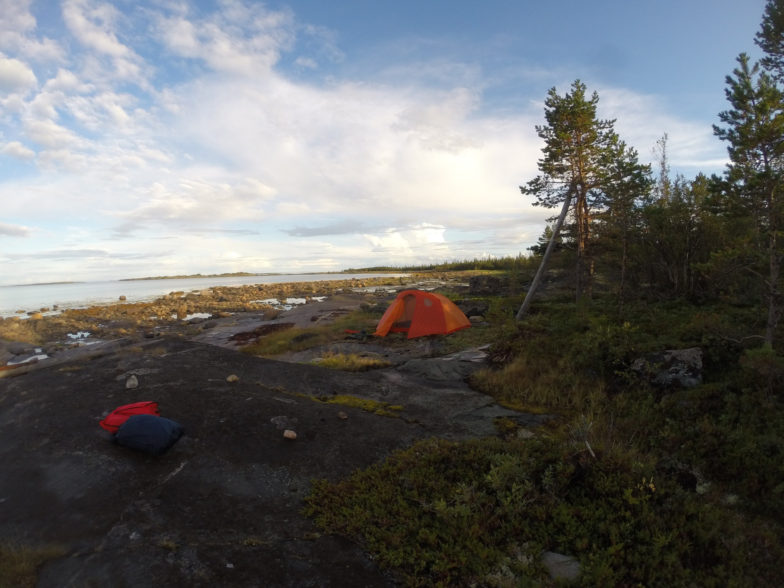
After lunch we go on to Chernetsky Island. The wind doesn't get stronger, and thanks for that at least. On Chernetsky it turns out that the hut marked on the map is long gone. We camp in a bay sheltered from all winds, which at low tide turns into an almost impassable wall.
It rained all day, and the campsites are very wet; we don't want to pitch the tent in the woods at all, so we camp right on the shore, above the high-tide line.
An uninhabited island — check. The sea — check. The sun — check. Summer was a success.
Covered 37 kilometers, like in our best days. Extremely tired; we quickly set up camp, had dinner and konked out. Passed the 200 km mark. In total we've now covered 230.
Day 12Kem. Finish
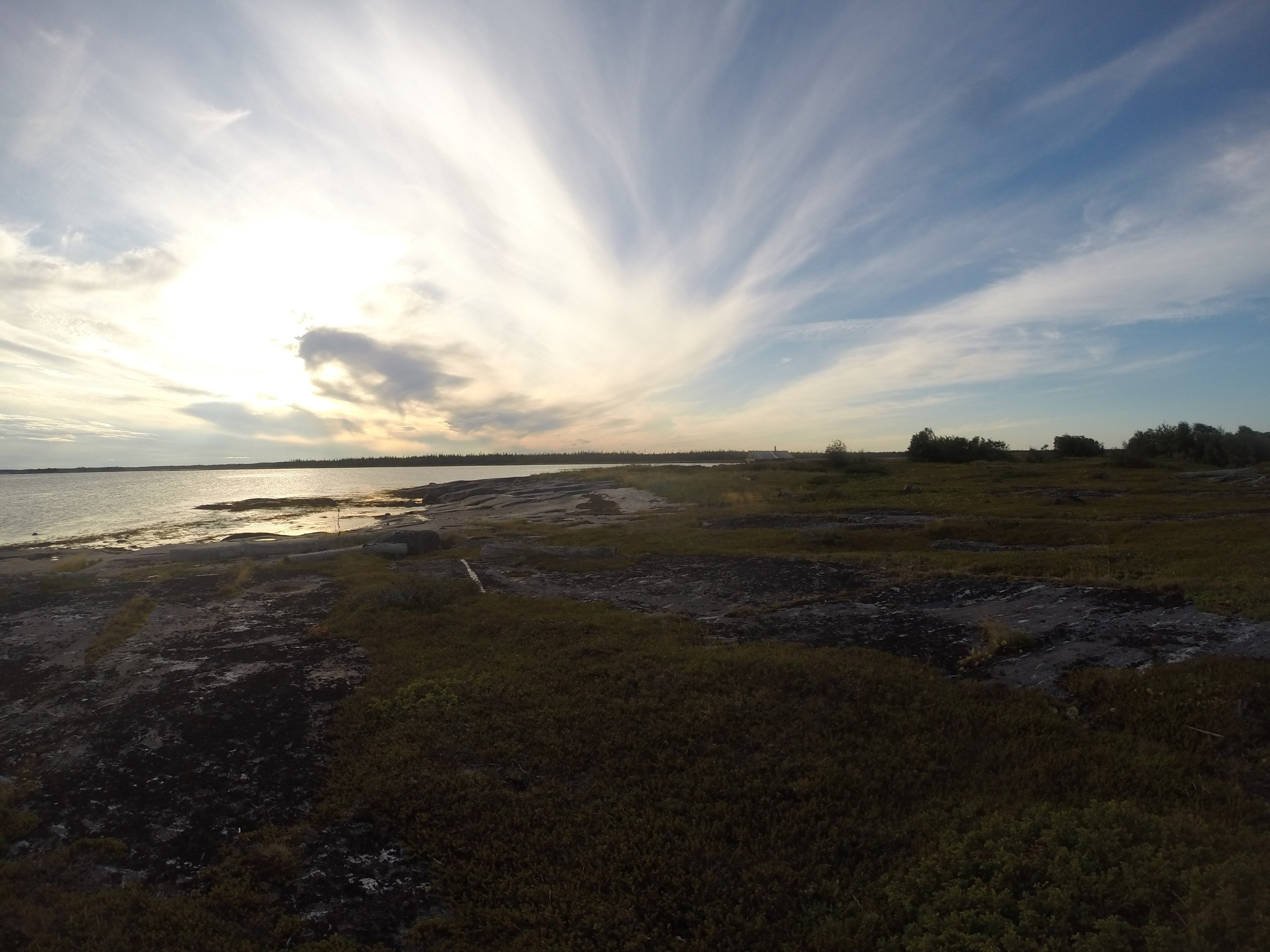
The mood is fighting fit. Everything aches after yesterday, but we have to go. We woke to the drumming of rain on the tent. We pack up and set off. There's almost no wind, or it's very light. Our goal is the Studentsy Islands, with a possible stop at Zelenaya Luda. That's 15 kilometers, and we're taking a big risk if the weather worsens.
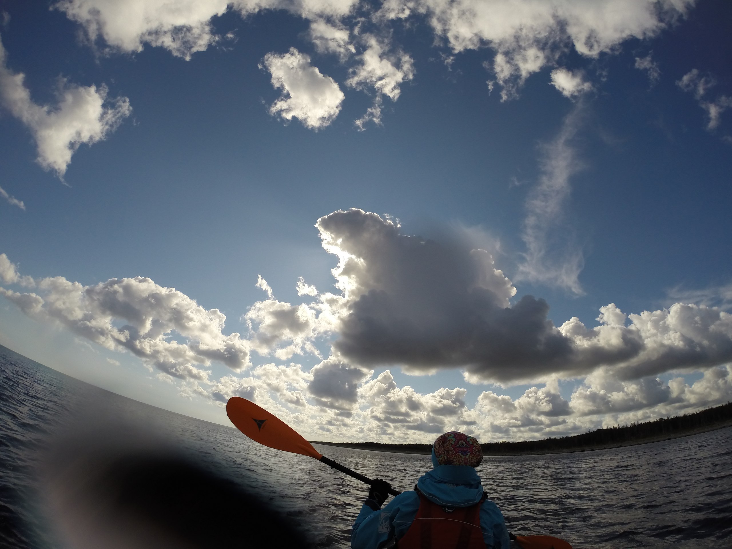
But luck is with us; we go fairly fast, watch seals and belugas. The sky paints the most beautiful pictures, reflected in the almost mirror-smooth surface of the sea; in the distance you can see Solovki and the Gorelye Islands, and the feeling that all of this is unreal doesn't leave us.
A distinctive feature of this part of the route was that at a fair distance from shore you could encounter a shallow-lying shoal; that's a touch uncomfortable.
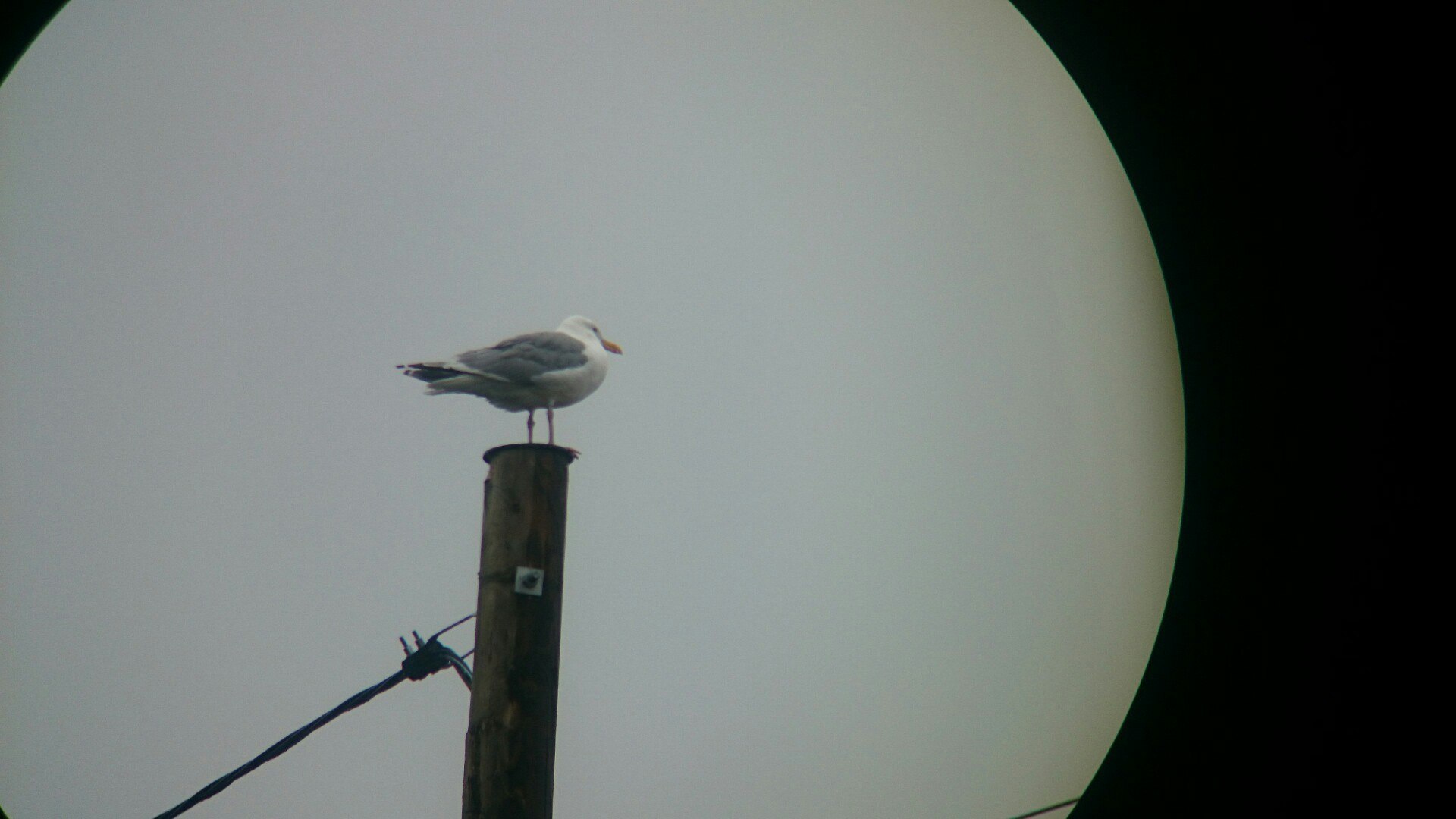
Before the Studentsy we stop to rest on a rock crowded with gulls. Everything's fine in the "Ladoga," but your behind goes numb fast, and 2 and a half hours is already a trial, though our most serious trial was on Onega, when we didn't get out of the kayak for 4.5 hours.
After the Studentsy we head for October Revolution Island, with lunch planned on it. 500 meters before the island's tip a powerful wind switches on, one that now has to be reckoned with. We barely paddle up to a little bay on the island, hide from the wind behind some rocks, have lunch. About 4 kilometers remain to the goal, and after lunch we cover them in almost an hour; the wind, in parting, lashes mercilessly, but luckily we're not on open water and there's no room for the waves to build. Well, that is — the waves are good ones, it's just that in the open they'd be lashing us even harder.
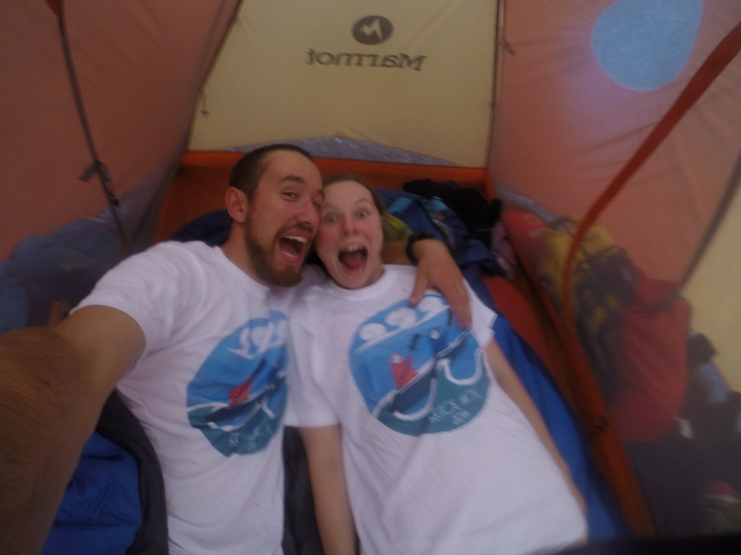
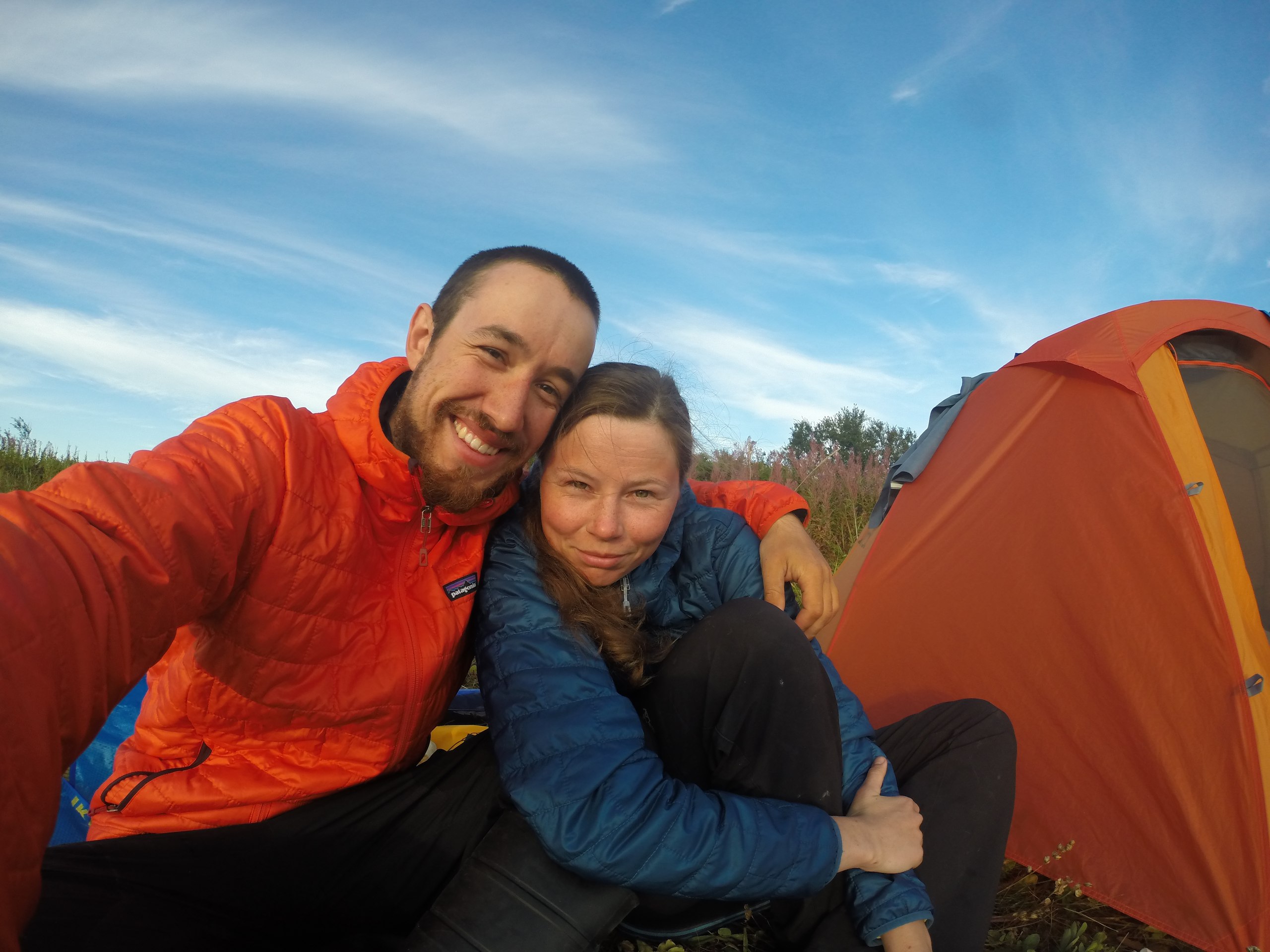
We land a little way off from Rabocheostrovsk on some scrap of sand. Joy, happiness, mixed feelings that it's all over.
We were very lucky to cover 20 kilometers in good weather, and I was even grateful to the wind for the last 4 kilometers; it made for a very "White Sea" send-off. We were already packing up in the rain, everything soaked through.
Covered 24 kilometers.
Then came the long hike to Rabocheostrovsk, the search for a taxi able to take us with all our things, the ride to depressing Kem. A tip — don't go to Kem. Better to stay at the pier in Rabocheostrovsk; there's nothing in Kem except a museum.
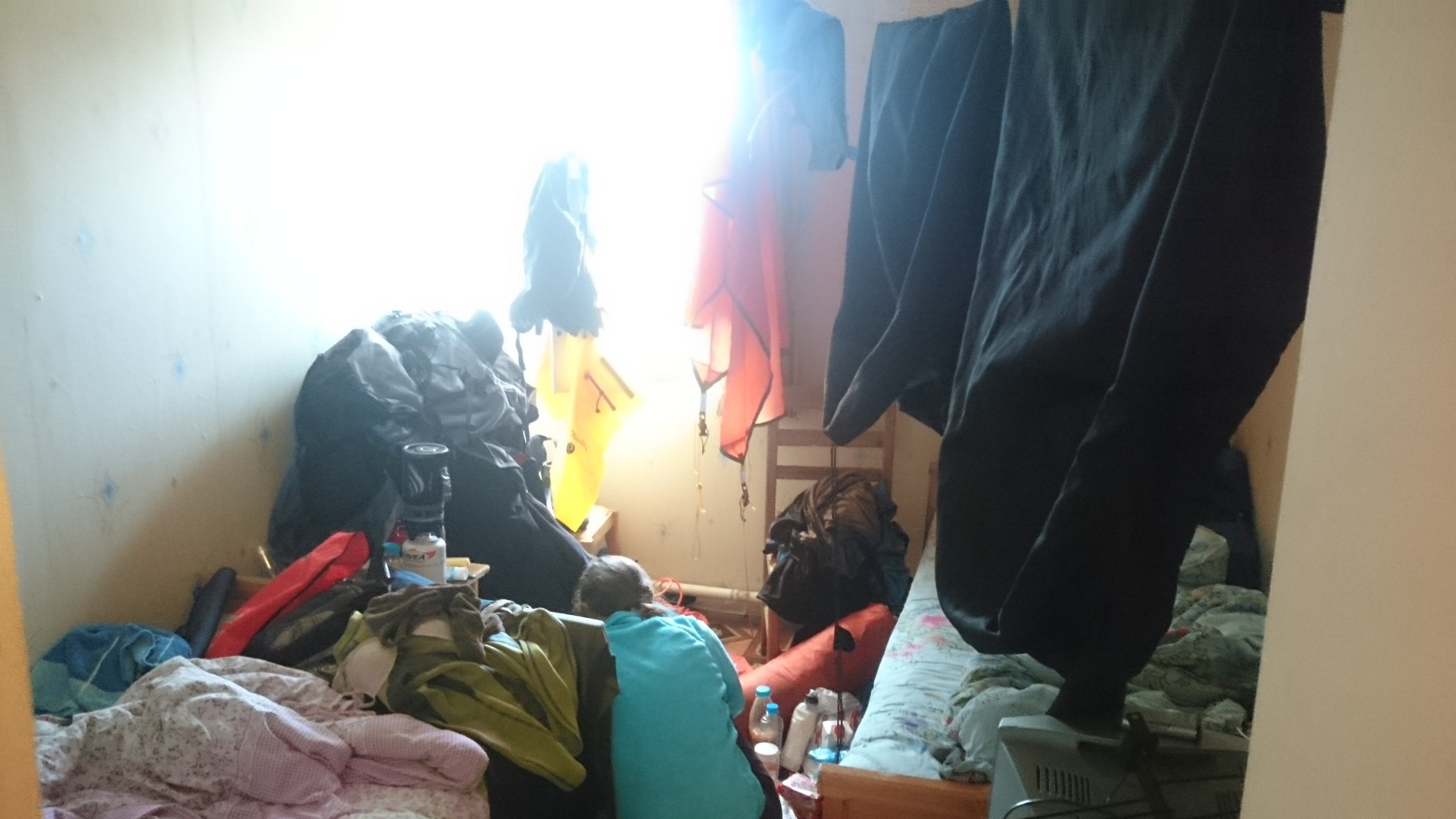
In Kem we stayed at the fleabag "Kuzova," notable only, perhaps, for having a heater. The next day we dried all our things and walked around Kem.
The following day we made a trip out to Solovki and realized it's better to go there for several days and with a guided tour. And a day after that we left for Murmansk, where we fulfilled a cherished dream: to gather mushrooms to our heart's content — but that's not really worth recounting.
Conclusions.
254 kilometers in 12 days, of which 10 were paddling days — a little over 20 km/day on average, which is actually very good. We had a heap of food left over.
We traveled a very beautiful route, enjoyed the views of the Karelian shore of the White Sea, saw seals, bearded seals, belugas, a variety of birds. We gathered cloudberries, bog bilberries, lingonberries. We ate mussels. We slept in fishing huts. We paddled in every kind of wind, got acquainted with how quickly the weather changes at sea.
I believe that over the course of this journey we gained a greater calm, contemplating the northern nature.
Probably the most important thing is that we grew significantly closer spiritually, though I hadn't thought we could be any closer. Paddling in one boat somehow contributes to this, I suppose. After we got back to Moscow a friend asked me: "Weren't you two bored together?" And I didn't understand the question. We're never bored together.
Where we screwed up
- We didn't have a clear tide schedule for the key points of the route; you can get one using the X Tide program.
- We'd initially wanted to try traveling in the evenings and at night, but forgot to account for the fact that the white nights were long over, and the day was starting to shorten rapidly.
- We underestimated the seriousness of the korgi; there are a lot of them and just as many rocks capable of damaging the kayak.
- It would probably have been worth bringing some kind of solid fuel for kindling in the damp forest; we hadn't expected to be lighting campfires.
- We stopped in Kem when we could have not done so at all.
- We should have brought cool ziplocks rather than IKEA ones; the latter tear easily.
- Most of our food was not in dry bags but in ordinary bags. We counted on the packaging being watertight, and that hope let us down a few times. A pack of pasta and a pack of crispbread got damp and the jar of dried tomatoes leaked.
Gear that let us down
- The "Ladoga" rudder lines
- The Garmin GPSMAP 78sc, took on water. Had it not — it would have earned only praise, very convenient to use.
- The PowerFilm R14, took on water, though previously I'd considered it the best battery in the world. That's how it goes.
- The Limeade Power Bank 18000mAh, just died. It had been with us on every trip since Iceland; a real shame.
- The "special-purpose matches for fishermen" — a terrible piece of junk that wouldn't burn and gave only acrid smoke; lighting anything with them was flat-out impossible.
Gear that performed at its best
- The Morakniv Companion MG knife — an excellent knife for trips
- The Palm membrane suits — your bottoms always dry and clean
- Compass and map
- The Suunto Ambit 2 watch. Genuinely waterproof.
- The Splav and SealLine dry bags
- The Jetboil. Well, it always performs well, basically
- The Olympus binoculars, the lightest of the waterproof ones (660 grams)
- The Adventure Technology Pursuit paddles — light and comfortable
- The GoPro HD Hero 3+, just try and kill this little thing